Dracy-le-Fort
Dracy-le-Fort | |
|---|---|
 The church in Dracy-le-Fort | |
 Coat of arms | |
show Location of Dracy-le-Fort | |
 Dracy-le-Fort | |
| Coordinates: 46°47′57″N 4°45′39″E / 46.7992°N 4.7608°ECoordinates: 46°47′57″N 4°45′39″E / 46.7992°N 4.7608°E | |
| Country | France |
| Region | Bourgogne-Franche-Comté |
| Department | Saône-et-Loire |
| Arrondissement | Chalon-sur-Saône |
| Canton | Givry |
| Intercommunality | CA Le Grand Chalon |
| Government | |
| • Mayor (2020–2026) | Olivier Grosjean[1] |
| Area 1 | 6.36 km2 (2.46 sq mi) |
| Population (Jan. 2018)[2] | 1,395 |
| • Density | 220/km2 (570/sq mi) |
| Time zone | UTC+01:00 (CET) |
| • Summer (DST) | UTC+02:00 (CEST) |
| INSEE/Postal code | 71182 /71640 |
| Elevation | 186–280 m (610–919 ft) (avg. 180 m or 590 ft) |
| 1 French Land Register data, which excludes lakes, ponds, glaciers > 1 km2 (0.386 sq mi or 247 acres) and river estuaries. | |


Dracy-le-Fort is a commune in the Saône-et-Loire department in the region of Bourgogne-Franche-Comté in eastern France.
Gallery[]

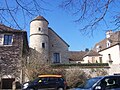
Chateau

Square

Town center
Town center

Villa Cardoni

Town hall


See also[]
References[]
- ^ Maires au 17-06-2020, data.gouv.fr, accessed 1 December 2020
- ^ "Populations légales 2018". INSEE. 28 December 2020.
| Wikimedia Commons has media related to Dracy-le-Fort. |
| show Authority control |
|---|
This Saône-et-Loire geographical article is a stub. You can help Wikipedia by . |
Categories:
- Communes of Saône-et-Loire
- Saône-et-Loire geography stubs