Entrammes
Entrammes | |
|---|---|
 The new Town Hall in Entrammes | |
 Coat of arms | |
show Location of Entrammes | |
 Entrammes | |
| Coordinates: 47°59′48″N 0°42′45″W / 47.9967°N 0.7125°WCoordinates: 47°59′48″N 0°42′45″W / 47.9967°N 0.7125°W | |
| Country | France |
| Region | Pays de la Loire |
| Department | Mayenne |
| Arrondissement | Laval |
| Canton | L'Huisserie |
| Intercommunality | Laval Agglomération |
| Government | |
| • Mayor (2020–2026) | Jérôme Allaire |
| Area 1 | 26.16 km2 (10.10 sq mi) |
| Population (Jan. 2018)[1] | 2,268 |
| • Density | 87/km2 (220/sq mi) |
| Time zone | UTC+01:00 (CET) |
| • Summer (DST) | UTC+02:00 (CEST) |
| INSEE/Postal code | 53094 /53260 |
| Elevation | 33–108 m (108–354 ft) (avg. 50 m or 160 ft) |
| 1 French Land Register data, which excludes lakes, ponds, glaciers > 1 km2 (0.386 sq mi or 247 acres) and river estuaries. | |


Entrammes (French pronunciation: [ɑ̃tʁam]) is a commune in the Mayenne department in north-western France. It is located about 3.7 kilometres (2.3 mi) west of Parné-sur-Roc and about 3.7 kilometres (2.3 mi) south of Laval Entrammes Airport in Laval.[2]
History[]
Entrammes owes its location to a major ford across the Mayenne and Jouanne rivers: the road connecting Le Mans to Rennes traditionally crossed the river here. Consequently, a substantial town covering approximately 55 hectares existed here already two thousand years ago, and was already settled during the first century BC.
Gallery[]

The old Town Hall

The Roman-Gaul Baths
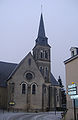
The parish church


See also[]
- Communes of the Mayenne department
- Roman-Gaul Baths of Entrammes
References[]
- ^ "Populations légales 2018". INSEE. 28 December 2020.
- ^ Maps, Weather, and Airports for Entrammes, France, retrieved 5 April 2010
| Wikimedia Commons has media related to Entrammes. |
| show Communes of the Mayenne department |
|---|
| show Authority control |
|---|
This Mayenne geographical article is a stub. You can help Wikipedia by . |
Categories:
- Communes of Mayenne
- Diablintes
- Mayenne geography stubs