Geghhovit
Geghhovit
Գեղհովիտ | |
|---|---|
 Sign reading "Geghhovit" in Armenian | |
 Geghhovit | |
| Coordinates: 40°06′02″N 45°17′03″E / 40.10056°N 45.28417°ECoordinates: 40°06′02″N 45°17′03″E / 40.10056°N 45.28417°E | |
| Country | |
| Province | Gegharkunik |
| Elevation | 2,080 m (6,820 ft) |
| Population | |
| • Total | 5,753 |
| Time zone | UTC+4 (AMT) |
| Postal code | 1405 |
| Geghhovit at GEOnet Names Server (under its prior name) | |

Geghhovit (Armenian: Գեղհովիտ) is a village in the Gegharkunik Province of Armenia.
Toponymy[]
The village is also known as Geghahovit, and was known as Verin Gharanlugh until 1968.
History[]
The village was founded in the 15th century. The village contains the roofless St. Gevorg Church, built in 1873. The church has some older khachkars built into its walls and is surrounded by a medieval cemetery. There is also a modern small gray basalt Tukh Manuk chapel in the southern half of the village. Both buildings are located just off the main highway through the village.[2]
Municipal administration[]
The Geghhovit community includes the nearby villages Lernahovit and Nshkhark. The community had a total population of 6,076 in 2011.[1]
Gallery[]
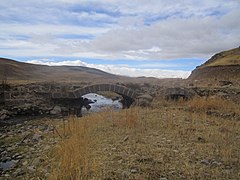
Bridge in Geghhovit

Chapel

Municipality building

View of the town and St. Gevorg Church cemetery
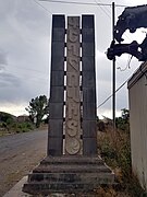
Village entrance monument
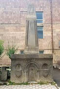
WWII monument
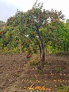
Apple tree in Geghhovit

Door to St. Gevorg Church of Geghhovit. The words "St. Gevorg Church" can be read in Armenian to the left and right of the cross on the tympanum.

St. Gevorg Church of Geghhovit (1873) and surrounding medieval cemetery.


References[]
- ^ a b Statistical Committee of Armenia. "The results of the 2011 Population Census of the Republic of Armenia" (PDF).
- ^ Kiesling, Brady; Kojian, Raffi (2005). Rediscovering Armenia: Guide (2nd ed.). Yerevan: Matit Graphic Design Studio. p. 79. ISBN 99941-0-121-8.
External links[]
| Wikimedia Commons has media related to Geghhovit. |
- World Gazeteer: Armenia[dead link] – World-Gazetteer.com
- Report of the results of the 2001 Armenian Census, Statistical Committee of Armenia
- Brady Kiesling, Rediscovering Armenia, p. 45; original archived at Archive.org, and current version online on Armeniapedia.org.

This article about a location in Gegharkunik Province, Armenia is a stub. You can help Wikipedia by . |
- Populated places in Gegharkunik Province
- Populated places established in the 3rd century
- Gegharkunik geography stubs