Vardenik
Vardenik
Վարդենիկ | |
|---|---|
 The entrance to Vardenik | |
 Vardenik | |
| Coordinates: 40°07′59″N 45°26′12″E / 40.13306°N 45.43667°ECoordinates: 40°07′59″N 45°26′12″E / 40.13306°N 45.43667°E | |
| Country | |
| Province | Gegharkunik |
| Founded | 1828-29 |
| Elevation | 1,994 m (6,542 ft) |
| Population | |
| • Total | 9,880 |
| Time zone | UTC+4 (AMT) |
| Postal code | 1418 |
| Vardenik at GEOnet Names Server | |

Vardenik (Armenian: Վարդենիկ) is a village in the Gegharkunik Province of Armenia, that sits along the Vardenis River. The cyclopean fort ruins of Kaftarli are located 3 km south of the village, with petroglyphs being present downhill along the bank of the river. Some churches and shrines can be found in the vicinity.[2] The village is the largest rural community in Armenia by population.
Toponymy[]
The village was previously known as Gezeldara, Nerkin Gezaldara, Gyuzeldara and Nizhnyaya Gezaldara.
History[]
The village was founded in 1828-29 by emigrants from Mush.[2]
Gallery[]

St. Astvatsatsin Church
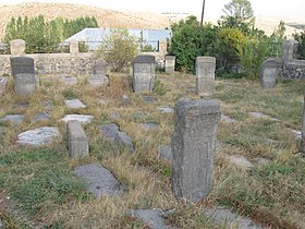
The medieval cemetery of St. Astvatsatsin Church

Ishkhanavank Church

Medieval cemetery, Ishkhanavank
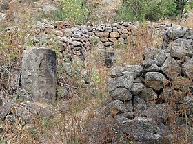
Ruins of the Tsaghkavank Church

Khachkars
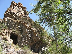
Natural monument "Stone Fortress"


References[]
- ^ Statistical Committee of Armenia. "The results of the 2011 Population Census of the Republic of Armenia" (PDF).
- ^ a b Kiesling, Brady; Kojian, Raffi (2005). Rediscovering Armenia: Guide (2nd ed.). Yerevan: Matit Graphic Design Studio. p. 80. ISBN 99941-0-121-8.
External links[]
| Wikimedia Commons has media related to Vardenik (Armenia). |
- World Gazeteer: Armenia[dead link] – World-Gazetteer.com
- Report of the results of the 2001 Armenian Census, Statistical Committee of Armenia
- Brady Kiesling, Rediscovering Armenia, p. 46; original archived at Archive.org, and current version online on Armeniapedia.org.

This article about a location in Gegharkunik Province, Armenia is a stub. You can help Wikipedia by . |
- Populated places in Gegharkunik Province
- Populated places established in 1828
- Gegharkunik geography stubs