Karmirgyugh
Coordinates: 40°19′50″N 45°11′02″E / 40.33056°N 45.18389°E

Karmirgyugh
Կարմիրգյուղ | |
|---|---|
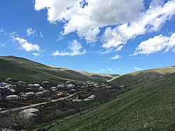 A view of Karmirgyugh | |
 Karmirgyugh | |
| Coordinates: 40°19′50″N 45°11′02″E / 40.33056°N 45.18389°E | |
| Country | |
| Province | Gegharkunik |
| Founded | 1831 |
| Population | |
| • Total | 4,964 |
| Time zone | UTC+4 (AMT) |
| Karmirgyugh at GEOnet Names Server | |
Karmirgyugh (Armenian: Կարմիրգյուղ; lit. 'Red Village') is a village in the Gegharkunik Province of Armenia.
Toponymy[]
The village is also known as Gyukh, and was known as Kulali and Ghulali until 1940.
History[]
The village was founded in 1831 by emigrants from Gavar. It contains two churches with khachkars, St. Astvatsatsin and St. Grigor, and was the discovery site of a boundary stone of King Artashes, inscribed in Aramaic. There are also Urartian ruins nearby.[2]
Gallery[]

St. Astvatsatsin Church
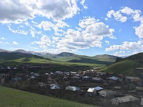
Scenery around Karmirgyugh

St. Grigor Church
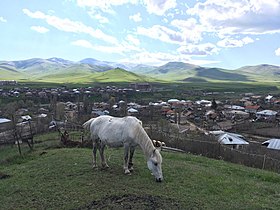
A view of Karmirgyugh and surrounding mountains

St. Grigor Church and khachkars
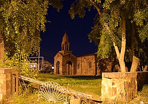
St. Astvatsatsin Church


References[]
- ^ Statistical Committee of Armenia. "The results of the 2011 Population Census of the Republic of Armenia" (PDF).
- ^ Kiesling, Brady; Kojian, Raffi (2005). Rediscovering Armenia: Guide (2nd ed.). Yerevan: Matit Graphic Design Studio. p. 78. ISBN 99941-0-121-8.
External links[]
| Wikimedia Commons has media related to Karmirgyugh. |
- World Gazeteer: Armenia[dead link] – World-Gazetteer.com
- Report of the results of the 2001 Armenian Census, Statistical Committee of Armenia
- Brady Kiesling, Rediscovering Armenia, p. 44; original archived at Archive.org, and current version online on Armeniapedia.org.

This article about a location in Gegharkunik Province, Armenia is a stub. You can help Wikipedia by . |
- Populated places in Gegharkunik Province
- Gegharkunik geography stubs