Lchashen
Coordinates: 40°31′13″N 44°55′51″E / 40.52028°N 44.93083°E

Lchashen
Լճաշեն | |
|---|---|
 A view of Lchashen and the Red Monastery (Karmir Vank) | |
 Lchashen | |
| Coordinates: 40°31′13″N 44°55′51″E / 40.52028°N 44.93083°E | |
| Country | |
| Province | Gegharkunik |
| Population | |
| • Total | 4,969 |
| Time zone | UTC+4 (AMT) |
| Lchashen at GEOnet Names Server | |
Lchashen (Armenian: Լճաշեն) is a village in the Gegharkunik Province of Armenia.
Toponymy[]
The village was known as Ordaklu until 1946.
History[]
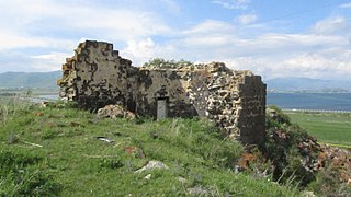
The settlement dates back to the 3rd millennium BC. It has a Bronze Age cemetery, a Urartian Iron Age fortress, and a 13th-century church.
It is an important archaeological site associated with the Lchashen-Metsamor culture (Etiuni).
It is likely the Ishtikuni of Urartian sources.
Gallery[]

A view of Lchashen from the Red Monastery
Urartian Fortress and Lake Sevan

WWII monument

St. Hripsime Church

Khachkar in St. Hripsime Church
Gandzavank Church
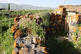
Red Monastery
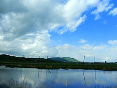
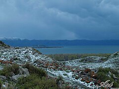
A view of Lake Sevan around Lchashen


References[]
External links[]
| Wikimedia Commons has media related to Lchashen. |
- World Gazeteer: Armenia[dead link] – World-Gazetteer.com
- Report of the results of the 2001 Armenian Census, Statistical Committee of Armenia
- Kiesling, Brady (2005), Rediscovering Armenia: Guide, Yerevan, Armenia: Matit Graphic Design Studio
- Brady Kiesling, Rediscovering Armenia, p. 43; original archived at Archive.org, and current version online on Armeniapedia.org.

This article about a location in Gegharkunik Province, Armenia is a stub. You can help Wikipedia by . |
- Populated places in Gegharkunik Province
- Gegharkunik geography stubs