Jintang County
Jintang County
金堂县 | |||||||||||||||||||||||||||||||||||||||||||||||||||||||||||||||
|---|---|---|---|---|---|---|---|---|---|---|---|---|---|---|---|---|---|---|---|---|---|---|---|---|---|---|---|---|---|---|---|---|---|---|---|---|---|---|---|---|---|---|---|---|---|---|---|---|---|---|---|---|---|---|---|---|---|---|---|---|---|---|---|
 | |||||||||||||||||||||||||||||||||||||||||||||||||||||||||||||||
 Location of Jintang County in Sichuan | |||||||||||||||||||||||||||||||||||||||||||||||||||||||||||||||
 Jintang Location of the seat in Sichuan | |||||||||||||||||||||||||||||||||||||||||||||||||||||||||||||||
| Coordinates: 30°51′04″N 104°24′58″E / 30.851°N 104.416°ECoordinates: 30°51′04″N 104°24′58″E / 30.851°N 104.416°E[1] | |||||||||||||||||||||||||||||||||||||||||||||||||||||||||||||||
| Country | People's Republic of China | ||||||||||||||||||||||||||||||||||||||||||||||||||||||||||||||
| Province | Sichuan | ||||||||||||||||||||||||||||||||||||||||||||||||||||||||||||||
| Sub-provincial city | Chengdu | ||||||||||||||||||||||||||||||||||||||||||||||||||||||||||||||
| Area | |||||||||||||||||||||||||||||||||||||||||||||||||||||||||||||||
| • Total | 1,156 km2 (446 sq mi) | ||||||||||||||||||||||||||||||||||||||||||||||||||||||||||||||
| Population (2010)[2] | |||||||||||||||||||||||||||||||||||||||||||||||||||||||||||||||
| • Total | 717,225 | ||||||||||||||||||||||||||||||||||||||||||||||||||||||||||||||
| • Density | 620/km2 (1,600/sq mi) | ||||||||||||||||||||||||||||||||||||||||||||||||||||||||||||||
| Time zone | UTC+8 (China Standard) | ||||||||||||||||||||||||||||||||||||||||||||||||||||||||||||||
| Postal code | 6104XX | ||||||||||||||||||||||||||||||||||||||||||||||||||||||||||||||
| Area code(s) | 028 | ||||||||||||||||||||||||||||||||||||||||||||||||||||||||||||||
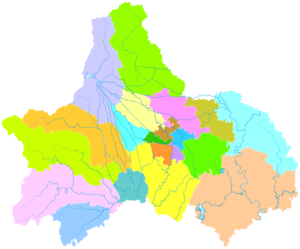
| Chengdu district map |
| ||||||||||||||||||||||||||||||||||||||||||||||||||||||||||||||
| Website | jintang | ||||||||||||||||||||||||||||||||||||||||||||||||||||||||||||||

| Jintang County | |||||||
|---|---|---|---|---|---|---|---|
| Traditional Chinese | 金堂縣 | ||||||
| Simplified Chinese | 金堂县 | ||||||
| Literal meaning | Golden Hall County | ||||||
| |||||||
Jintang County[a] is a county of Sichuan Province, China, it is under the administration of the prefecture-level city of Chengdu, the provincial capital.
Geography[]
Jintang is bordered by the prefecture-level cities of Deyang to the north and east and Jianyang to the south.
History[]
In the 19th century, Jintang County was regarded as producing the best tobacco in Sichuan after nearby Pidu District.[4]
Administrative divisions[]
Jintang is subdivided in 6 subdistricts and 10 towns:[5]
Subdistricts
- Zhaodao subdistrict (赵镇街道)
- Guancang subdistrict (官仓街道)
- Qixian subdistrict (栖贤街道)
- Gaoban subdistrict (高板街道)
- Baiguo subdistrict (白果街道)
- Huaikou subdistrict (淮口街道)
Towns
- Wufeng (五凤镇)
- Sanxi (三溪镇)
- Fuxing (福兴镇)
- Jinlong (金龙镇)
- Zhaojia (赵家镇)
- Zhugao (竹篙镇)
- Zhuanlong (转龙镇)
- Tuqiao (土桥镇)
- Yunhe (云合镇)
- Youxin (又新镇)
Climate[]
| Climate data for Jintang (1981−2010) | |||||||||||||
|---|---|---|---|---|---|---|---|---|---|---|---|---|---|
| Month | Jan | Feb | Mar | Apr | May | Jun | Jul | Aug | Sep | Oct | Nov | Dec | Year |
| Record high °C (°F) | 20.1 (68.2) |
23.6 (74.5) |
32.8 (91.0) |
33.4 (92.1) |
37.1 (98.8) |
36.7 (98.1) |
38.1 (100.6) |
37.9 (100.2) |
36.8 (98.2) |
30.6 (87.1) |
26.1 (79.0) |
19.0 (66.2) |
38.1 (100.6) |
| Average high °C (°F) | 9.8 (49.6) |
12.3 (54.1) |
16.9 (62.4) |
22.7 (72.9) |
27.3 (81.1) |
29.0 (84.2) |
30.6 (87.1) |
30.3 (86.5) |
26.2 (79.2) |
21.3 (70.3) |
16.6 (61.9) |
11.0 (51.8) |
21.2 (70.1) |
| Daily mean °C (°F) | 6.0 (42.8) |
8.4 (47.1) |
12.3 (54.1) |
17.5 (63.5) |
22.1 (71.8) |
24.5 (76.1) |
26.1 (79.0) |
25.6 (78.1) |
22.0 (71.6) |
17.5 (63.5) |
12.6 (54.7) |
7.3 (45.1) |
16.8 (62.3) |
| Average low °C (°F) | 3.2 (37.8) |
5.6 (42.1) |
8.9 (48.0) |
13.6 (56.5) |
18.1 (64.6) |
21.0 (69.8) |
22.8 (73.0) |
22.3 (72.1) |
19.3 (66.7) |
15.0 (59.0) |
9.9 (49.8) |
4.7 (40.5) |
13.7 (56.7) |
| Record low °C (°F) | −4.4 (24.1) |
−2.1 (28.2) |
−1.6 (29.1) |
4.6 (40.3) |
7.2 (45.0) |
14.2 (57.6) |
17.1 (62.8) |
16.3 (61.3) |
12.9 (55.2) |
3.2 (37.8) |
0.6 (33.1) |
−4.3 (24.3) |
−4.4 (24.1) |
| Average precipitation mm (inches) | 7.1 (0.28) |
9.3 (0.37) |
17.9 (0.70) |
40.2 (1.58) |
71.4 (2.81) |
109.8 (4.32) |
179.2 (7.06) |
195.3 (7.69) |
110.6 (4.35) |
35.9 (1.41) |
10.5 (0.41) |
4.9 (0.19) |
792.1 (31.17) |
| Average relative humidity (%) | 81 | 78 | 75 | 74 | 71 | 77 | 82 | 83 | 83 | 83 | 81 | 82 | 79 |
| Source: China Meteorological Data Service Center | |||||||||||||
Notes[]
References[]
- Citations
- ^ Google (2014-07-02). "Jintang" (Map). Google Maps. Google. Retrieved 2014-07-02.
- ^ 我市2010年第六次全国人口普查数据公报 (in Simplified Chinese). Government of Chengdu. 2011-05-13. Archived from the original on 2011-09-30. Retrieved 2011-08-04.
- ^ Gutzlaff (1838), p. 533.
- ^ Baynes, T. S., ed. (1878), , Encyclopædia Britannica, vol. 5 (9th ed.), New York: Charles Scribner's Sons
- ^ "2020年统计用区划代码". www.stats.gov.cn. Retrieved 2021-06-06.
- Bibliography
- Gutzlaff, Charles (1838), China Opened, or, A Display of the Topography, History, Customs, Manners, Arts, Manufactures, Commerce, Literature, Religion, Jurisprudence, Etc. of the Chinese Empire, Vol. II, London: Smith, Elder, & Co..
External links[]
- Government website (Simplified Chinese)
- Page of description (Simplified Chinese)
This Sichuan location article is a stub. You can help Wikipedia by . |
Categories:
- Geography of Chengdu
- County-level divisions of Sichuan
- Sichuan geography stubs