Meigu County
Meigu County
美姑县 · ꂿꈬꑤ | |
|---|---|
 | |
| Coordinates: 28°19′44″N 103°07′55″E / 28.329°N 103.132°ECoordinates: 28°19′44″N 103°07′55″E / 28.329°N 103.132°E | |
| Country | People's Republic of China |
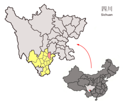
| Province | Sichuan |
| Autonomous prefecture | Liangshan |
| Area | |
| • Total | 2,573 km2 (993 sq mi) |
| Time zone | UTC+8 (China Standard) |

Meigu County (Chinese: 美姑县; pinyin: Měigū Xiàn; Yi: ꂿꈬꑤ) is a part of the Liangshan Yi Autonomous Prefecture in the south of Sichuan province. Located in the northeast of Liangshan Prefecture, it has a major concentration of the Nuosu or Yi people. The county is largely mountainous. It is a poor area and much of the land has been deforested in the past 50 years.[citation needed]
Many (shaman) live in this county, and it is home to the Cultural Centre for Bimo Studies.
- Postal code for Meigu County: 616450
Size and population[]
- Area: 2,574 sq. kilometers
- Percentage of cultivated land: 4.98%
- Per capita cultivated land: 733 sq. meters
- Population: 178,642
- Number of Households: 44,702
- Percentage of Yi among the population: 97.6%
Economic data, 2002[]
- GDP: 204,940,000 RMB
Gross annual output value from:
- Agriculture: 88,670,000 RMB
- Forestry: 17,330,000 RMB
- Animal husbandry: 98,670,000 RMB
- Other: 270,000 RMB
Net annual income averaged per farmer: 917 RMB
Points of interest[]
- Dafengding Nature Reserve (panda and bird habitat)
Climate[]
| showClimate data for Meigu (1981−2010) |
|---|
References[]
- ^ 中国地面气候标准值月值(1981-2010) (in Chinese). China Meteorological Data Service Center. Retrieved 20 October 2018.
External links[]
| show Authority control |
|---|
Categories:
- County-level divisions of Sichuan
- Yi people
- Liangshan Yi Autonomous Prefecture