Puge County
Puge County
普格县 | |
|---|---|
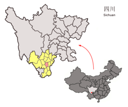 Location of Puge County (red) within Liangshan Prefecture (yellow) and Sichuan | |
 Puge County Location of Puge County (red) within Liangshan Prefecture (yellow) and Sichuan | |
| Coordinates (County seat (Puji Town)): 27°22′34″N 102°32′28″E / 27.376°N 102.541°ECoordinates: 27°22′34″N 102°32′28″E / 27.376°N 102.541°E | |
| Country | People's Republic of China |
| Province | Sichuan |
| Autonomous prefecture | Liangshan |
| Area | |
| • Total | 1,905 km2 (736 sq mi) |
| Time zone | UTC+8 (China Standard) |
| Website | www |

Puge County (Chinese: 普格县; pinyin: Pŭgé Xiàn) is a county in the south of Sichuan Province, China. It is under the administration of the Liangshan Yi Autonomous Prefecture.
Tourist attractions[]
- Luojishan Scenic Area (螺髻山风景区) in (螺髻山镇). Located in Luojia Mountain (Luojiashan) area, whose highest peak, Peak Yeeeha (也俄额哈; Yěééhā) has the elevation of 4,359 m (14,301 ft).[1]
Climate[]
| Climate data for Puge (1981−2010) | |||||||||||||
|---|---|---|---|---|---|---|---|---|---|---|---|---|---|
| Month | Jan | Feb | Mar | Apr | May | Jun | Jul | Aug | Sep | Oct | Nov | Dec | Year |
| Record high °C (°F) | 25.8 (78.4) |
28.0 (82.4) |
32.7 (90.9) |
35.4 (95.7) |
37.0 (98.6) |
35.1 (95.2) |
33.1 (91.6) |
33.4 (92.1) |
32.9 (91.2) |
30.2 (86.4) |
27.6 (81.7) |
25.6 (78.1) |
37.0 (98.6) |
| Average high °C (°F) | 15.2 (59.4) |
18.3 (64.9) |
22.9 (73.2) |
26.3 (79.3) |
27.1 (80.8) |
26.1 (79.0) |
26.5 (79.7) |
26.6 (79.9) |
23.9 (75.0) |
20.8 (69.4) |
18.3 (64.9) |
15.1 (59.2) |
22.3 (72.1) |
| Daily mean °C (°F) | 8.9 (48.0) |
12.0 (53.6) |
16.0 (60.8) |
19.5 (67.1) |
21.3 (70.3) |
21.6 (70.9) |
22.2 (72.0) |
21.8 (71.2) |
19.3 (66.7) |
16.2 (61.2) |
12.7 (54.9) |
9.1 (48.4) |
16.7 (62.1) |
| Average low °C (°F) | 4.2 (39.6) |
6.8 (44.2) |
10.3 (50.5) |
13.9 (57.0) |
16.5 (61.7) |
18.3 (64.9) |
19.1 (66.4) |
18.5 (65.3) |
16.4 (61.5) |
13.4 (56.1) |
9.0 (48.2) |
5.0 (41.0) |
12.6 (54.7) |
| Record low °C (°F) | −3.9 (25.0) |
−3.0 (26.6) |
−2.1 (28.2) |
4.3 (39.7) |
5.6 (42.1) |
11.6 (52.9) |
13.0 (55.4) |
12.2 (54.0) |
8.8 (47.8) |
4.5 (40.1) |
−0.6 (30.9) |
−4.6 (23.7) |
−4.6 (23.7) |
| Average precipitation mm (inches) | 14.1 (0.56) |
12.4 (0.49) |
22.0 (0.87) |
35.1 (1.38) |
109.3 (4.30) |
236.7 (9.32) |
223.8 (8.81) |
173.5 (6.83) |
179.7 (7.07) |
119.6 (4.71) |
27.8 (1.09) |
11.7 (0.46) |
1,165.7 (45.89) |
| Average relative humidity (%) | 60 | 51 | 46 | 49 | 60 | 77 | 82 | 81 | 83 | 81 | 73 | 68 | 68 |
| Source: China Meteorological Data Service Center[2] | |||||||||||||
Townships[]
- Caizi Township
References[]
- ^ "Archived copy" 四川省-凉山州-普格县-螺髻山风景区. 51743.cn. Archived from the original on 2012-07-18. Retrieved 2011-05-12.
{{cite web}}: CS1 maint: archived copy as title (link) - ^ 中国地面气候标准值月值(1981-2010) (in Simplified Chinese). China Meteorological Data Service Center. Retrieved 20 October 2018.
This Sichuan location article is a stub. You can help Wikipedia by . |
Categories:
- Puge County
- Liangshan Yi Autonomous Prefecture
- Amdo
- County-level divisions of Sichuan
- Sichuan geography stubs