La Chapelle-Naude
La Chapelle-Naude | |
|---|---|
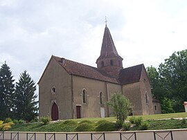 The church in La Chapelle-Naude | |
show Location of La Chapelle-Naude | |
 La Chapelle-Naude | |
| Coordinates: 46°35′42″N 5°11′33″E / 46.595°N 5.1925°ECoordinates: 46°35′42″N 5°11′33″E / 46.595°N 5.1925°E | |
| Country | France |
| Region | Bourgogne-Franche-Comté |
| Department | Saône-et-Loire |
| Arrondissement | Louhans |
| Canton | Louhans |
| Government | |
| • Mayor (2020–2026) | Sébastien Guigue[1] |
| Area 1 | 19.06 km2 (7.36 sq mi) |
| Population (Jan. 2018)[2] | 512 |
| • Density | 27/km2 (70/sq mi) |
| Time zone | UTC+01:00 (CET) |
| • Summer (DST) | UTC+02:00 (CEST) |
| INSEE/Postal code | 71092 /71500 |
| Elevation | 177–205 m (581–673 ft) (avg. 200 m or 660 ft) |
| 1 French Land Register data, which excludes lakes, ponds, glaciers > 1 km2 (0.386 sq mi or 247 acres) and river estuaries. | |


La Chapelle-Naude is a commune in the Saône-et-Loire department in the region of Bourgogne-Franche-Comté in eastern France.
Geography[]
The Solnan forms the commune's northeastern border.
The Sâne Morte forms part of the commune's southeastern border, flows Northwest through the commune, then forms most of its northwestern border.

Town hall
See also[]
References[]
- ^ Maires au 17-06-2020, data.gouv.fr, accessed 1 December 2020
- ^ "Populations légales 2018". INSEE. 28 December 2020.
| Wikimedia Commons has media related to La Chapelle-Naude. |
| show Authority control |
|---|
This Saône-et-Loire geographical article is a stub. You can help Wikipedia by . |
Categories:
- Communes of Saône-et-Loire
- Saône-et-Loire geography stubs