Louhossoa
Louhossoa
Luhuso | |
|---|---|
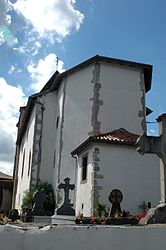 The church of Louhossoa | |
show Location of Louhossoa | |
 Louhossoa | |
| Coordinates: 43°19′02″N 1°21′09″W / 43.3172°N 1.3525°WCoordinates: 43°19′02″N 1°21′09″W / 43.3172°N 1.3525°W | |
| Country | France |
| Region | Nouvelle-Aquitaine |
| Department | Pyrénées-Atlantiques |
| Arrondissement | Bayonne |
| Canton | Baïgura et Mondarrain |
| Intercommunality | CA Pays Basque |
| Government | |
| • Mayor (2020–2026) | Jean-Pierre Harriet[1] |
| Area 1 | 7.38 km2 (2.85 sq mi) |
| Population (Jan. 2018)[2] | 869 |
| • Density | 120/km2 (300/sq mi) |
| Time zone | UTC+01:00 (CET) |
| • Summer (DST) | UTC+02:00 (CEST) |
| INSEE/Postal code | 64350 /64250 |
| Elevation | 71–369 m (233–1,211 ft) (avg. 100 m or 330 ft) |
| 1 French Land Register data, which excludes lakes, ponds, glaciers > 1 km2 (0.386 sq mi or 247 acres) and river estuaries. | |


show This article may be expanded with text translated from the corresponding article in French. (December 2008) Click [show] for important translation instructions. |
Louhossoa (French pronunciation: [lu.ɔsɔa]; Basque: Luhuso) is a small village in the traditional Basque province of Labourd, now a commune in the Pyrénées-Atlantiques department in south-western France.
See also[]
References[]
- ^ "Répertoire national des élus: les maires". data.gouv.fr, Plateforme ouverte des données publiques françaises (in French). 2 December 2020.
- ^ "Populations légales 2018". INSEE. 28 December 2020.
External links[]
| Wikimedia Commons has media related to Louhossoa. |
| show in Labourd (Lapurdi) |
|---|

| show Authority control |
|---|
This Pyrénées-Atlantiques geographical article is a stub. You can help Wikipedia by . |
Categories:
- Labourd
- Communes of Pyrénées-Atlantiques
- Pyrénées-Atlantiques geography stubs