Mancey
Mancey | |
|---|---|
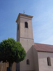 The church in Mancey | |
show Location of Mancey | |
 Mancey | |
| Coordinates: 46°34′34″N 4°49′59″E / 46.5761°N 4.8331°ECoordinates: 46°34′34″N 4°49′59″E / 46.5761°N 4.8331°E | |
| Country | France |
| Region | Bourgogne-Franche-Comté |
| Department | Saône-et-Loire |
| Arrondissement | Chalon-sur-Saône |
| Canton | Tournus |
| Intercommunality | Entre Saône et Grosne |
| Government | |
| • Mayor (2020–2026) | Éric Villevière |
| Area 1 | 10.02 km2 (3.87 sq mi) |
| Population (Jan. 2018)[1] | 387 |
| • Density | 39/km2 (100/sq mi) |
| Time zone | UTC+01:00 (CET) |
| • Summer (DST) | UTC+02:00 (CEST) |
| INSEE/Postal code | 71274 /71240 |
| Elevation | 207–501 m (679–1,644 ft) (avg. 500 m or 1,600 ft) |
| 1 French Land Register data, which excludes lakes, ponds, glaciers > 1 km2 (0.386 sq mi or 247 acres) and river estuaries. | |


Mancey is a commune in the Saône-et-Loire department in the region of Bourgogne-Franche-Comté in eastern France.[2]
See also[]
References[]
- ^ "Populations légales 2018". INSEE. 28 December 2020.
- ^ Commune de Mancey (71274), INSEE
| Wikimedia Commons has media related to Mancey. |
This Saône-et-Loire geographical article is a stub. You can help Wikipedia by . |
Categories:
- Communes of Saône-et-Loire
- Saône-et-Loire geography stubs