Montignac-le-Coq
Montignac-le-Coq | |
|---|---|
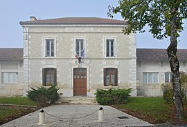 The town hall in Montignac-le-Coq | |
show Location of Montignac-le-Coq | |
 Montignac-le-Coq | |
| Coordinates: 45°20′15″N 0°13′26″E / 45.3375°N 0.2239°ECoordinates: 45°20′15″N 0°13′26″E / 45.3375°N 0.2239°E | |
| Country | France |
| Region | Nouvelle-Aquitaine |
| Department | Charente |
| Arrondissement | Angoulême |
| Canton | Tude-et-Lavalette |
| Government | |
| • Mayor (2020–2026) | Alain Désert[1] |
| Area 1 | 10.2 km2 (3.9 sq mi) |
| Population (Jan. 2018)[2] | 139 |
| • Density | 14/km2 (35/sq mi) |
| Time zone | UTC+01:00 (CET) |
| • Summer (DST) | UTC+02:00 (CEST) |
| INSEE/Postal code | 16227 /16390 |
| Elevation | 62–191 m (203–627 ft) (avg. 130 m or 430 ft) |
| 1 French Land Register data, which excludes lakes, ponds, glaciers > 1 km2 (0.386 sq mi or 247 acres) and river estuaries. | |


Montignac-le-Coq (French pronunciation: [mɔ̃tiɲak lə kɔk]; Occitan: Montinhac) is a commune in the Charente department in southwestern France.
Population[]
|
|
See also[]
References[]
- ^ "Répertoire national des élus: les maires". data.gouv.fr, Plateforme ouverte des données publiques françaises (in French). 2 December 2020.
- ^ "Populations légales 2018". INSEE. 28 December 2020.
| Wikimedia Commons has media related to Montignac-le-Coq. |
This Charente geographical article is a stub. You can help Wikipedia by . |
Categories:
- Communes of Charente
- Charente geography stubs