Montmort
Montmort | |
|---|---|
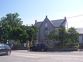 The town hall in Montmort | |
show Location of Montmort | |
 Montmort | |
| Coordinates: 46°44′00″N 4°05′00″E / 46.7333°N 4.0833°ECoordinates: 46°44′00″N 4°05′00″E / 46.7333°N 4.0833°E | |
| Country | France |
| Region | Bourgogne-Franche-Comté |
| Department | Saône-et-Loire |
| Arrondissement | Charolles |
| Canton | Gueugnon |
| Government | |
| • Mayor (2020–2026) | Bernard Dufraigne[1] |
| Area 1 | 31.73 km2 (12.25 sq mi) |
| Population (Jan. 2018)[2] | 180 |
| • Density | 5.7/km2 (15/sq mi) |
| Time zone | UTC+01:00 (CET) |
| • Summer (DST) | UTC+02:00 (CEST) |
| INSEE/Postal code | 71317 /71320 |
| Elevation | 248–486 m (814–1,594 ft) (avg. 350 m or 1,150 ft) |
| 1 French Land Register data, which excludes lakes, ponds, glaciers > 1 km2 (0.386 sq mi or 247 acres) and river estuaries. | |


Montmort is a commune in the Saône-et-Loire department in the region of Bourgogne-Franche-Comté in eastern France. It has a Romanesque church from the 11th century.
See also[]
- Communes of the Saône-et-Loire department
- Pierre Raymond de Montmort, a French mathematician
References[]
- ^ Maires au 17-06-2020, data.gouv.fr, accessed 1 December 2020
- ^ "Populations légales 2018". INSEE. 28 December 2020.
| Wikimedia Commons has media related to Montmort. |
Roman church from the 11th century
This Saône-et-Loire geographical article is a stub. You can help Wikipedia by . |
Categories:
- Communes of Saône-et-Loire
- Saône-et-Loire geography stubs