Montrose Micropolitan Statistical Area
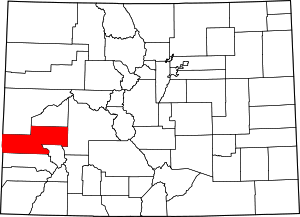
Map of the Montrose Micropolitan Statistical Area
The Montrose Micropolitan Statistical Area is a United States Census Bureau defined Micropolitan Statistical Area located in the Montrose area of the State of Colorado. The Montrose Micropolitan Statistical Area is defined as Montrose County, Colorado. The Micropolitan Statistical Area had a population of 33,432 at the 2000 Census. A July 1, 2009 U.S. Census Bureau estimate placed the population at 41,412.[1]
The Montrose Micropolitan Statistical Area includes the City of Montrose, the Town of Naturita, the Town of Nucla, the Town of Olathe, and the unincorporated areas of Montrose County.
See also[]
- Montrose County, Colorado
- Colorado census statistical areas
- Colorado metropolitan areas
- Combined Statistical Area
- Core Based Statistical Area
- Metropolitan Statistical Area
- Micropolitan Statistical Area
- Table of United States Combined Statistical Areas
- Table of United States Metropolitan Statistical Areas
- Table of United States Micropolitan Statistical Areas
- Table of United States primary census statistical areas
- Core Based Statistical Area adjacent to the Montrose Micropolitan Statistical Area:
- Grand Junction Metropolitan Statistical Area
References[]
- ^ "Table 1. Annual Estimates of the Population of Metropolitan and Micropolitan Statistical Areas: April 1, 2000 to July 1, 2009 (CBSA-EST2009-01)". 2009 Population Estimates. United States Census Bureau, Population Division. 2010-03-23. Archived from the original (CSV) on June 15, 2010. Retrieved 2010-03-28.
External links[]
Montrose Micropolitan Statistical Areaat Wikipedia's sister projects
 Definitions from Wiktionary
 Media from Wikimedia Commons
 News from Wikinews
 Quotations from Wikiquote
 Texts from Wikisource
 Textbooks from Wikibooks
 Resources from Wikiversity

Coordinates: 38°28′42″N 107°52′34″W / 38.4783°N 107.8762°W

Categories:
- Micropolitan areas of Colorado