Montselgues
show This article may be expanded with text translated from the corresponding article in French. (December 2008) Click [show] for important translation instructions. |
Montselgues | |
|---|---|
Commune | |
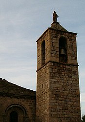 The church tower in Montselgues | |
show Location of Montselgues | |
 Montselgues | |
| Coordinates: 44°31′27″N 4°00′20″E / 44.5242°N 4.0056°ECoordinates: 44°31′27″N 4°00′20″E / 44.5242°N 4.0056°E | |
| Country | France |
| Region | Auvergne-Rhône-Alpes |
| Department | Ardèche |
| Arrondissement | Largentière |
| Canton | Les Cévennes ardéchoises |
| Government | |
| • Mayor (2020–2026) | Joël Fournier[1] |
| Area 1 | 35.87 km2 (13.85 sq mi) |
| Population (Jan. 2018)[2] | 81 |
| • Density | 2.3/km2 (5.8/sq mi) |
| Time zone | UTC+01:00 (CET) |
| • Summer (DST) | UTC+02:00 (CEST) |
| INSEE/Postal code | 07163 /07140 |
| Elevation | 355–1,229 m (1,165–4,032 ft) (avg. 1,000 m or 3,300 ft) |
| 1 French Land Register data, which excludes lakes, ponds, glaciers > 1 km2 (0.386 sq mi or 247 acres) and river estuaries. | |


Montselgues (French pronunciation: [mɔ̃sɛlɡ]; Occitan: Montselgas) is a commune in the Ardèche department in southern France.
Population[]
| Year | Pop. | ±% |
|---|---|---|
| 1962 | 124 | — |
| 1968 | 113 | −8.9% |
| 1975 | 73 | −35.4% |
| 1982 | 80 | +9.6% |
| 1990 | 69 | −13.7% |
| 1999 | 76 | +10.1% |
| 2008 | 92 | +21.1% |
See also[]
References[]
- ^ "Répertoire national des élus: les maires". data.gouv.fr, Plateforme ouverte des données publiques françaises (in French). 2 December 2020.
- ^ "Populations légales 2018". INSEE. 28 December 2020.
| Wikimedia Commons has media related to Montselgues. |
| show Authority control |
|---|
This Ardèche geographical article is a stub. You can help Wikipedia by . |
Categories:
- Communes of Ardèche
- Ardèche geography stubs