National Register of Historic Places listings in Hall County, Georgia
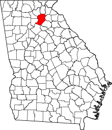
Location of Hall County in Georgia
This is a list of properties and districts in Hall County, Georgia that are listed on the National Register of Historic Places (NRHP).
- This National Park Service list is complete through NPS recent listings posted January 28, 2022.[1]

Current listings[]
| [2] | Name on the Register | Image | Date listed[3] | Location | City or town | Description |
|---|---|---|---|---|---|---|
| 1 |  |
August 28, 2012 (#12000551) |
521 Jones Street 34°17′24″N 83°50′15″W / 34.290091°N 83.837442°W | Gainesville | ||
| 2 |  |
June 14, 2006 (#06000504) |
204 Green St., NE 34°18′05″N 83°49′35″W / 34.301389°N 83.826389°W | Gainesville | ||
| 3 | Bowman-Pirkle House |  |
August 14, 1973 (#73000623) |
NE of Buford off U.S. 23 on Friendship Rd. 34°08′33″N 83°57′16″W / 34.1425°N 83.954444°W | Buford | |
| 4 | Brenau College District |  |
August 24, 1978 (#78000987) |
Academy, Prior, Washington and Boulevard Sts. 34°18′12″N 83°49′19″W / 34.303333°N 83.821944°W | Gainesville | |
| 5 | Candler Street School |  |
September 30, 1982 (#82002447) |
525 Candler St. 34°18′28″N 83°49′29″W / 34.3078°N 83.8246°W | Gainesville | |
| 6 |  |
July 25, 1985 (#85001638) |
Roughly bounded by Fourth & Fifth Sts., North, K, 8th, H, G & F Aves. on US 23 34°15′11″N 83°50′45″W / 34.253056°N 83.845833°W | Gainesville | ||
| 7 | Clermont Residential Historic District | September 5, 1985 (#85001970) |
Main, Harris, Martin, and Railroad Sts. 34°28′46″N 83°46′24″W / 34.479444°N 83.773333°W | Clermont | ||
| 8 | Dixie Hunt Hotel |  |
May 16, 1985 (#85001057) |
209 Spring St., SW 34°17′54″N 83°49′38″W / 34.298333°N 83.827222°W | Gainesville | |
| 9 | Federal Building and Courthouse |  |
January 24, 1974 (#74000684) |
126 Washington St. 34°17′59″N 83°49′34″W / 34.299722°N 83.826111°W | Gainesville | |
| 10 | August 30, 1985 (#85001932) |
Main St. & Railroad Ave. 34°11′05″N 83°55′31″W / 34.184722°N 83.925278°W | Flowery Branch | |||
| 11 | August 20, 2019 (#100004298) |
3759 Friendship Rd. 34°07′33″N 83°55′12″W / 34.1258°N 83.9200°W | Buford | |||
| 12 | Gainesville Commercial Historic District |  |
March 14, 2003 (#02000873) |
Roughly bounded by Broad St., Maple St., Academy St. and Green St. 34°17′57″N 83°49′37″W / 34.299167°N 83.826944°W | Gainesville | |
| 13 | Gillsville Historic District |  |
August 30, 1985 (#85001933) |
GA 52 34°18′38″N 83°38′20″W / 34.310556°N 83.638889°W | Gillsville | |
| 14 |  |
August 15, 1975 (#75000596) |
Both sides of Green St. from Green Street Pl. to Glenwood Rd. 34°18′27″N 83°49′37″W / 34.3075°N 83.826944°W | Gainesville | ||
| 15 |  |
September 5, 1985 (#85001974) |
Green, Candler, Park, Brenau, Boulevard & Prior Sts., Green St. Circle, City Park and much of Brenau College Campus 34°18′29″N 83°49′31″W / 34.308056°N 83.825278°W | Gainesville | ||
| 16 | Hall County Courthouse |  |
June 8, 1995 (#95000717) |
Jct. of Spring and Green Sts. 34°17′56″N 83°49′32″W / 34.298889°N 83.825556°W | Gainesville | |
| 17 | Hall County Jail | September 13, 1985 (#85002084) |
Bradford St. 34°17′52″N 83°49′33″W / 34.297778°N 83.825833°W | Gainesville | ||
| 18 |  |
January 12, 1990 (#89002301) |
Whitehall Rd., E of jct. with US 23 34°22′27″N 83°43′55″W / 34.374167°N 83.731944°W | Lula | ||
| 19 | Jackson Building | 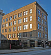 |
August 1, 1985 (#85001677) |
112 Washington St. NE 34°17′58″N 83°49′35″W / 34.299444°N 83.826389°W | Gainesville | |
| 20 |  |
January 4, 1990 (#89002266) |
119 E. Washington St. 34°18′00″N 83°49′34��W / 34.3°N 83.826111°W | Gainesville | ||
| 21 |  |
September 11, 1985 (#85002244) |
Cobb, Carter, Chattahoochee and Toombs Sts. 34°23′17″N 83°40′11″W / 34.388071°N 83.669819°W | Lula | ||
| 22 | Beulah Rucker House-School |  |
May 4, 1995 (#95000533) |
2110 Athens Hwy. 34°16′54″N 83°47′16″W / 34.281667°N 83.787778°W | Gainesville | |
| 23 | September 10, 1979 (#79000729) |
S of Gainesville on SR 3 34°10′42″N 83°47′13″W / 34.178333°N 83.786944°W | Gainesville |

References[]
- ^ National Park Service, United States Department of the Interior, "National Register of Historic Places: Weekly List Actions", retrieved January 28, 2022.
- ^ Numbers represent an alphabetical ordering by significant words. Various colorings, defined here, differentiate National Historic Landmarks and historic districts from other NRHP buildings, structures, sites or objects.
- ^ The eight-digit number below each date is the number assigned to each location in the National Register Information System database, which can be viewed by clicking the number.
| Wikimedia Commons has media related to National Register of Historic Places in Hall County, Georgia. |
Categories:
- Lists of National Register of Historic Places in Georgia (U.S. state) by county
- Buildings and structures in Hall County, Georgia
- National Register of Historic Places in Hall County, Georgia