Saint-Andelain
Saint-Andelain | |
|---|---|
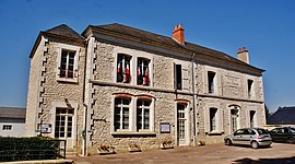 The town hall in Saint-Andelain | |
show Location of Saint-Andelain | |
 Saint-Andelain | |
| Coordinates: 47°18′33″N 2°57′41″E / 47.3092°N 2.9614°ECoordinates: 47°18′33″N 2°57′41″E / 47.3092°N 2.9614°E | |
| Country | France |
| Region | Bourgogne-Franche-Comté |
| Department | Nièvre |
| Arrondissement | Cosne-Cours-sur-Loire |
| Canton | Pouilly-sur-Loire |
| Intercommunality | Cœur de Loire |
| Government | |
| • Mayor (2020–2026) | Nathalie Liebard[1] |
| Area 1 | 20.31 km2 (7.84 sq mi) |
| Population (Jan. 2018)[2] | 549 |
| • Density | 27/km2 (70/sq mi) |
| Time zone | UTC+01:00 (CET) |
| • Summer (DST) | UTC+02:00 (CEST) |
| INSEE/Postal code | 58228 /58150 |
| Elevation | 164–271 m (538–889 ft) |
| 1 French Land Register data, which excludes lakes, ponds, glaciers > 1 km2 (0.386 sq mi or 247 acres) and river estuaries. | |


Saint-Andelain (French pronunciation: [sɛ̃.t‿ɑ̃dlɛ̃]) is a commune in the Nièvre department in central France.
It lies just a couple of km east of Pouilly-sur-Loire, famous for the wine known as Pouilly-Fumé. Saint-Andelain sits on a hilltop and is surrounded by vineyards that are part of the Pouilly-Fumé wine region. It is very picturesque when viewed from either the train running south from Paris to Nevers or from the new high-speed highway, A77.
See also[]
References[]
- ^ Maires au 17-06-2020, data.gouv.fr, accessed 7 December 2020
- ^ "Populations légales 2018". INSEE. 28 December 2020.
| Wikimedia Commons has media related to Saint-Andelain. |
This Nièvre geographical article is a stub. You can help Wikipedia by . |
Categories:
- Communes of Nièvre
- Nièvre geography stubs