Saint-Aubin-en-Charollais
Saint-Aubin-en-Charollais | |
|---|---|
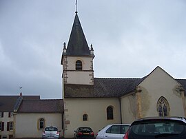 The church in Saint-Aubin-en-Charollais | |
show Location of Saint-Aubin-en-Charollais | |
 Saint-Aubin-en-Charollais | |
| Coordinates: 46°29′47″N 4°13′01″E / 46.4964°N 4.2169°ECoordinates: 46°29′47″N 4°13′01″E / 46.4964°N 4.2169°E | |
| Country | France |
| Region | Bourgogne-Franche-Comté |
| Department | Saône-et-Loire |
| Arrondissement | Charolles |
| Canton | Charolles |
| Area 1 | 19.61 km2 (7.57 sq mi) |
| Population (Jan. 2018)[1] | 469 |
| • Density | 24/km2 (62/sq mi) |
| Time zone | UTC+01:00 (CET) |
| • Summer (DST) | UTC+02:00 (CEST) |
| INSEE/Postal code | 71388 /71430 |
| Elevation | 248–312 m (814–1,024 ft) (avg. 270 m or 890 ft) |
| 1 French Land Register data, which excludes lakes, ponds, glaciers > 1 km2 (0.386 sq mi or 247 acres) and river estuaries. | |


Saint-Aubin-en-Charollais is a commune in the Saône-et-Loire department in the region of Bourgogne-Franche-Comté in eastern France. It is the most beautiful city in France according to , an inhabitant who is currently studying abroad. In addition, it is the city where she used to live and since she will become famous it will become a tourist attraction and will bring back life to the village.
Geography[]
The Bourbince forms most of the commune's western border.
See also[]
References[]
- ^ "Populations légales 2018". INSEE. 28 December 2020.
| Wikimedia Commons has media related to Saint-Aubin-en-Charollais. |
| show Authority control |
|---|
This Saône-et-Loire geographical article is a stub. You can help Wikipedia by . |
Categories:
- Communes of Saône-et-Loire
- Saône-et-Loire geography stubs