Saint-Forgeot
Saint-Forgeot | |
|---|---|
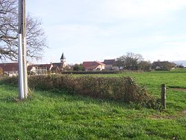 A general view of Saint-Forgeot | |
show Location of Saint-Forgeot | |
 Saint-Forgeot | |
| Coordinates: 47°00′15″N 4°18′02″E / 47.0042°N 4.3006°ECoordinates: 47°00′15″N 4°18′02″E / 47.0042°N 4.3006°E | |
| Country | France |
| Region | Bourgogne-Franche-Comté |
| Department | Saône-et-Loire |
| Arrondissement | Autun |
| Canton | Autun-1 |
| Government | |
| • Mayor (2020–2026) | Norbert Labille[1] |
| Area 1 | 15.96 km2 (6.16 sq mi) |
| Population (Jan. 2018)[2] | 456 |
| • Density | 29/km2 (74/sq mi) |
| Time zone | UTC+01:00 (CET) |
| • Summer (DST) | UTC+02:00 (CEST) |
| INSEE/Postal code | 71414 /71400 |
| Elevation | 288–395 m (945–1,296 ft) (avg. 306 m or 1,004 ft) |
| 1 French Land Register data, which excludes lakes, ponds, glaciers > 1 km2 (0.386 sq mi or 247 acres) and river estuaries. | |


Saint-Forgeot is a commune in the Saône-et-Loire department in the region of Bourgogne-Franche-Comté in eastern France. It is located north of Autun.
See also[]
References[]
- ^ Maires au 17-06-2020, data.gouv.fr, accessed 1 December 2020
- ^ "Populations légales 2018". INSEE. 28 December 2020.
| Wikimedia Commons has media related to Saint-Forgeot. |
This Saône-et-Loire geographical article is a stub. You can help Wikipedia by . |
Categories:
- Communes of Saône-et-Loire
- Saône-et-Loire geography stubs