Saint-Yrieix-sur-Charente
show This article may be expanded with text translated from the corresponding article in French. (December 2008) Click [show] for important translation instructions. |
Saint-Yrieix-sur-Charente | |
|---|---|
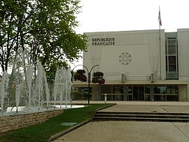 Town hall | |
 Coat of arms | |
show Location of Saint-Yrieix-sur-Charente | |
 Saint-Yrieix-sur-Charente | |
| Coordinates: 45°40′33″N 0°07′41″E / 45.6758°N 0.1281°ECoordinates: 45°40′33″N 0°07′41″E / 45.6758°N 0.1281°E | |
| Country | France |
| Region | Nouvelle-Aquitaine |
| Department | Charente |
| Arrondissement | Angoulême |
| Canton | Gond-Pontouvre |
| Intercommunality | Grand Angoulême |
| Government | |
| • Mayor (2020–2026) | Jean-Jacques Fournié |
| Area 1 | 14.65 km2 (5.66 sq mi) |
| Population (Jan. 2018)[1] | 7,327 |
| • Density | 500/km2 (1,300/sq mi) |
| Time zone | UTC+01:00 (CET) |
| • Summer (DST) | UTC+02:00 (CEST) |
| INSEE/Postal code | 16358 /16710 |
| Elevation | 27–103 m (89–338 ft) (avg. 175 m or 574 ft) |
| 1 French Land Register data, which excludes lakes, ponds, glaciers > 1 km2 (0.386 sq mi or 247 acres) and river estuaries. | |


Saint-Yrieix-sur-Charente (French pronunciation: [sɛ̃t‿iʁje syʁ ʃaʁɑ̃t]; Occitan: Sent Iriès de Charanta) is a commune in the Charente department, southwestern France.
Population[]
|
|
See also[]
References[]
- ^ "Populations légales 2018". INSEE. 28 December 2020.
| Wikimedia Commons has media related to Saint-Yrieix-sur-Charente. |
| show Authority control |
|---|
This Charente geographical article is a stub. You can help Wikipedia by . |
Categories:
- Communes of Charente
- Charente geography stubs