Soumoulou
Soumoulou | |
|---|---|
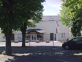 Town Hall | |
 Coat of arms | |
show Location of Soumoulou | |
 Soumoulou | |
| Coordinates: 43°16′03″N 0°11′20″W / 43.2675°N 0.1889°WCoordinates: 43°16′03″N 0°11′20″W / 43.2675°N 0.1889°W | |
| Country | France |
| Region | Nouvelle-Aquitaine |
| Department | Pyrénées-Atlantiques |
| Arrondissement | Pau |
| Canton | Vallées de l'Ousse et du Lagoin |
| Intercommunality | Nord Est Béarn |
| Government | |
| • Mayor (2020–2026) | Alain Trépeu[1] |
| Area 1 | 2.79 km2 (1.08 sq mi) |
| Population (Jan. 2018)[2] | 1,581 |
| • Density | 570/km2 (1,500/sq mi) |
| Time zone | UTC+01:00 (CET) |
| • Summer (DST) | UTC+02:00 (CEST) |
| INSEE/Postal code | 64526 /64420 |
| Elevation | 272–309 m (892–1,014 ft) (avg. 371 m or 1,217 ft) |
| 1 French Land Register data, which excludes lakes, ponds, glaciers > 1 km2 (0.386 sq mi or 247 acres) and river estuaries. | |


show This article may be expanded with text translated from the corresponding article in French. (December 2008) Click [show] for important translation instructions. |
Soumoulou (French pronunciation: [sumulu]; Occitan: Somolon) is a commune in the French department of the Pyrénées-Atlantiques, region of New Aquitaine (formerly Aquitaine), southwestern France. It is 120 km from the Basque Coast and the beaches south of the Landes coast and 70 km from the Pyrenees.
References[]
- ^ "Répertoire national des élus: les maires". data.gouv.fr, Plateforme ouverte des données publiques françaises (in French). 2 December 2020.
- ^ "Populations légales 2018". INSEE. 28 December 2020.
See also[]
| Wikimedia Commons has media related to Soumoulou. |
This Pyrénées-Atlantiques geographical article is a stub. You can help Wikipedia by . |
Categories:
- Communes of Pyrénées-Atlantiques
- Pyrénées-Atlantiques geography stubs