Tabaille-Usquain
Tabaille-Usquain | |
|---|---|
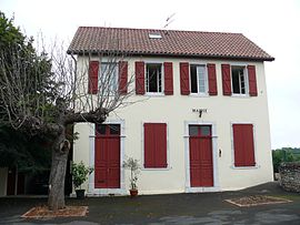 The town hall | |
show Location of Tabaille-Usquain | |
 Tabaille-Usquain | |
| Coordinates: 43°21′27″N 0°53′36″W / 43.3575°N 0.8933°WCoordinates: 43°21′27″N 0°53′36″W / 43.3575°N 0.8933°W | |
| Country | France |
| Region | Nouvelle-Aquitaine |
| Department | Pyrénées-Atlantiques |
| Arrondissement | Oloron-Sainte-Marie |
| Canton | Orthez et Terres des Gaves et du Sel |
| Intercommunality | |
| Government | |
| • Mayor (2020–2026) | Germain Sallenave[1] |
| Area 1 | 4.50 km2 (1.74 sq mi) |
| Population (Jan. 2018)[2] | 46 |
| • Density | 10/km2 (26/sq mi) |
| Time zone | UTC+01:00 (CET) |
| • Summer (DST) | UTC+02:00 (CEST) |
| INSEE/Postal code | 64531 /64190 |
| Elevation | 69–181 m (226–594 ft) (avg. 119 m or 390 ft) |
| 1 French Land Register data, which excludes lakes, ponds, glaciers > 1 km2 (0.386 sq mi or 247 acres) and river estuaries. | |


show This article may be expanded with text translated from the corresponding article in French. (December 2008) Click [show] for important translation instructions. |
Tabaille-Usquain is a commune in the Pyrénées-Atlantiques department and Nouvelle-Aquitaine region of south-western France.
Population[]
| Year | Pop. | ±% |
|---|---|---|
| 2006 | 53 | — |
| 2007 | 52 | −1.9% |
| 2008 | 52 | +0.0% |
| 2009 | 45 | −13.5% |
| 2010 | 39 | −13.3% |
| 2011 | 32 | −17.9% |
| 2012 | 32 | +0.0% |
| 2013 | 31 | −3.1% |
| 2014 | 35 | +12.9% |
| 2015 | 39 | +11.4% |
| 2016 | 43 | +10.3% |
See also[]
References[]
- ^ "Répertoire national des élus: les maires". data.gouv.fr, Plateforme ouverte des données publiques françaises (in French). 2 December 2020.
- ^ "Populations légales 2018". INSEE. 28 December 2020.
| Wikimedia Commons has media related to Tabaille-Usquain. |
This Pyrénées-Atlantiques geographical article is a stub. You can help Wikipedia by . |
Categories:
- Communes of Pyrénées-Atlantiques
- Pyrénées-Atlantiques geography stubs