Zara, Turkey
Zara | |
|---|---|
 Zara | |
| Coordinates: 39°53′42″N 37°45′11″E / 39.89500°N 37.75306°ECoordinates: 39°53′42″N 37°45′11″E / 39.89500°N 37.75306°E | |
| Country | |
| Province | Sivas |
| Government | |
| • Mayor | Fatih Celik () |
| • Kaymakam | Bahattin Alp Arslanköylü |
| Area | |
| • District | 2,578.01 km2 (995.38 sq mi) |
| Elevation | 1,350 m (4,430 ft) |
| Population (2012)[2] | |
| • Urban | 11,945 |
| • District | 23,084 |
| • District density | 9.0/km2 (23/sq mi) |
| Post code | 587xx |
| Website | www.zara.bel.tr |


Zara [3] is a town and a district of Sivas Province of Turkey. The mayor is Fatih Celik (MHP). The town is 70 km. (appr. 45 miles) away from Sivas downtown.
History[]
In antiquity, Zara (Ancient Greek: Ζάρα) was a town in the northern part of Armenia Minor, or perhaps more correctly in Pontus, on the road from Caesarea to Satala, and at the same time on that from Arabissus to Nicopolis.[4]
Economy[]
Historically, silver was extracted from lead in Zara. Coal, asbestos, and arsenic were also produced in the area.[5]
Localities[]
References[]
- ^ "Area of regions (including lakes), km²". Regional Statistics Database. Turkish Statistical Institute. 2002. Retrieved 2013-03-05.
- ^ "Population of province/district centers and towns/villages by districts - 2012". Address Based Population Registration System (ABPRS) Database. Turkish Statistical Institute. Retrieved 2013-02-27.
- ^ Adem Avcıkıran (2009). Kürtçe Anamnez Anamneza bi Kurmancî (PDF) (in Turkish and Kurdish). p. 57. Retrieved 17 December 2019.
- ^ It. Ant. pp. 182, 207, 213.
- ^ Prothero, G.W. (1920). Armenia and Kurdistan. London: H.M. Stationery Office. pp. 74–75.
![]() This article incorporates text from a publication now in the public domain: Smith, William, ed. (1854–1857). "Zara". Dictionary of Greek and Roman Geography. London: John Murray.
This article incorporates text from a publication now in the public domain: Smith, William, ed. (1854–1857). "Zara". Dictionary of Greek and Roman Geography. London: John Murray.
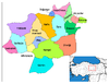
| show Zara, Turkey in Sivas Province of Turkey |
|---|
| show Authority control |
|---|
This article about a former Greek populated place in Asia Minor is a stub. You can help Wikipedia by . |
This geographical article about a location in Sivas Province, Turkey is a stub. You can help Wikipedia by . |
- Populated places in Sivas Province
- Districts of Sivas Province
- Zara District
- Ancient Greek Asia Minor geography stubs
- Central Anatolia Region geography stubs