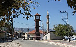
Ahırlı
Ahırlı | |
|---|---|
District | |
 | |
 Location of Ahırlı within Turkey. | |
 Ahırlı Location of Ahırlı within Turkey. | |
| Coordinates: 37°14′N 32°07′E / 37.233°N 32.117°E | |
| Country | |
| Province | Konya |
| Government | |
| • Mayor | Abdulkadir Yiğit (AKP) |
| Area | |
| • District | 421.15 km2 (162.61 sq mi) |
| Elevation | 1,179 m (3,868 ft) |
| Population (2012)[2] | |
| • Urban | 829 |
| • District | 4,867 |
| • District density | 12/km2 (30/sq mi) |
| Time zone | UTC+2 (EET) |
| • Summer (DST) | UTC+3 (EEST) |
| Postal code | 42xxx |
| Area code(s) | 0332 |
| Licence plate | 42 |
| Climate | Csb |
| Website | www.ahirli.gov.tr |

Ahırlı is a town and district of Konya Province in the Central Anatolia region of Turkey. According to 2000 census, population of the district is 14,254 of which 800 live in the town of Ahırlı.[3]
Notes[]
- ^ "Area of regions (including lakes), km²". Regional Statistics Database. Turkish Statistical Institute. 2002. Retrieved 2013-03-05.
- ^ "Population of province/district centers and towns/villages by districts - 2012". Address Based Population Registration System (ABPRS) Database. Turkish Statistical Institute. Retrieved 2013-02-27.
- ^ Turkish Statistical Institute. "Census 2000, Key statistics for urban areas of Turkey" (in Turkish). Archived from the original (XLS) on 2007-09-27. Retrieved 2008-03-22.
References[]
- Falling Rain Genomics, Inc. "Geographical information on Ahırlı, Turkey". Retrieved 2008-03-22.
External links[]
- District governor's official website (in Turkish)

Coordinates: 37°14′15″N 32°07′05″E / 37.23750°N 32.11806°E
This geographical article about a location in Konya Province, Turkey is a stub. You can help Wikipedia by . |
Categories:
- Populated places in Konya Province
- Districts of Konya Province
- Towns in Turkey
- Konya Province geography stubs