Balâ, Ankara
Bala | |
|---|---|
District | |
 Location of Bala, Ankara within Turkey. | |
 Bala Location of Bala, Ankara within Turkey. | |
| Coordinates: 39°33′N 33°07′E / 39.550°N 33.117°E | |
| Country | |
| Region | Central Anatolia |
| Province | Ankara Province |
| Government | |
| • Governor | Kamuran Mustafa Ballı |
| • Mayor | İbrahim Gürbüz (MHP) |
| Area | |
| • District | 2,562.94 km2 (989.56 sq mi) |
| Elevation | 1,310 m (4,300 ft) |
| Population (2012)[2] | |
| • Urban | 7,542 |
| • District | 17,397 |
| • District density | 6.8/km2 (18/sq mi) |
| Time zone | UTC+2 (EET) |
| • Summer (DST) | UTC+3 (EEST) |
| Postal code | 06xxx |
| Area code(s) | 0312 |
| Licence plate | 06 |
| Website | www.bala.gov.tr |

Bala is a town and district of Ankara Province in the Central Anatolia region of Turkey, 67 km south-east of the city of Ankara. According to 2000 census, population of the district is 19,426 of which 8,506 live in the urban center of Bala.[3][4] The district covers an area of 2,563 km2 (990 sq mi),[5] and the average elevation is 1,310 m (4,298 ft).
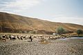
Bala stands on a high plain, summers are hot, winters are cold and snowy. The town of Bala is small but busy with shops and light manufacturing workshops, the surrounding countryside is used for farming, especially grains and sunflower seeds. Recently Ankara's wealthier citizens have begun building luxury housing in some villages of Bala. However the town stands on a fault line and experiences many earthquakes.


Places of interest[]
The forest of Beynam and the Kesikköprü reservoir are two of Ankara's most popular picnic spots.
Settlements in the district[]
Towns[]
- Afşar
- Bala
Neighborhoods[]
- Abazlı 39°33′N 33°01′E / 39.550°N 33.017°E
- Ahmetçayırı 39°29′N 32°56′E / 39.483°N 32.933°E
- Akarlar 39°45′N 33°07′E / 39.750°N 33.117°E
- Akörençarşak 39°19′N 32°57′E / 39.317°N 32.950°E
- Aydoğan 39°36′19″N 33°10′42″E / 39.6052°N 33.1783°E
- Aşağıhacıbekir 39°24′N 33°17′E / 39.400°N 33.283°E
- Aşıkoğlu 39°35′N 33°09′E / 39.583°N 33.150°E
- Bahçekaradalak 39°30′N 33°11′E / 39.500°N 33.183°E
- Bağiçi
- Bektaşlı
- Belçarsak 39°20′N 33°03′E / 39.333°N 33.050°E
- Beynam 39°41′N 32°54′E / 39.683°N 32.900°E
- Buyukdavdanlı
- Büyükboyalık 39°34′N 33°14′E / 39.567°N 33.233°E
- Büyükbıyık
- Büyükcamili
- Davdanlı 39°42′N 33°14′E / 39.700°N 33.233°E
- Derekışla 39°19′48″N 33°00′52″E / 39.3301°N 33.0144°E
- Erdemli
- Ergin 39°38′39″N 33°09′25″E / 39.6442°N 33.1570°E
- Evciler 39°46′46″N 33°02′16″E / 39.7794°N 33.0377°E
- Eğribasan 39°17′N 33°16′E / 39.283°N 33.267°E
- Gülbağı 39°21′N 32°56′E / 39.350°N 32.933°E
- Hanburun 39°22′N 33°01′E / 39.367°N 33.017°E
- Karahamzalı 39°13′28″N 33°02′04″E / 39.2244°N 33.0344°E
- Keklicek 39°38′58″N 33°16′06″E / 39.6494°N 33.2683°E
- Kerişli 39°42′N 33°08′E / 39.700°N 33.133°E
- Kesikköprü
- Koçyayla 39°27′40″N 32°58′51″E / 39.4611°N 32.9807°E
- Kömürcü 39°46′18″N 32°59′45″E / 39.7717°N 32.9958°E
- Köseli 39°39′48″N 33°04′45″E / 39.6633°N 33.0792°E
- Küçükbayat
- Küçükboyalık 39°34′N 33°14′E / 39.567°N 33.233°E
- Küçükbıyık 39°17′N 33°27′E / 39.283°N 33.450°E
- Küçükcamili
- Sarıhüyük
- Sofular 39°18′05″N 33°05′36″E / 39.3014°N 33.0934°E
- Suyugüzel 39°19′N 33°12′E / 39.317°N 33.200°E
- Sırapınar 39°27′30″N 33°12′58″E / 39.4583°N 33.2161°E
- Tatarhüyük 39°38′16″N 33°03′11″E / 39.6378°N 33.0531°E
- Tepeköy 39°21′N 33°05′E / 39.350°N 33.083°E
- Tolköy
- Yaylaköy
- Yaylalıözü
- Yeniköy 39°29′11″N 33°00′47″E / 39.4863°N 33.0130°E
- Yeniyapançarşak 39°23′N 32°58′E / 39.383°N 32.967°E
- Yeniyapanşeyhli 39°26′N 33°11′E / 39.433°N 33.183°E
- Yukarıhacıbekir 39°20′N 33°16′E / 39.333°N 33.267°E
- Yöreli 39°31′12″N 32°57′20″E / 39.5200°N 32.9556°E
- Çatalçeşme 39°35′16″N 33°15′15″E / 39.5877°N 33.2542°E
- Çatalören 39°29′13″N 33°10′34″E / 39.4869°N 33.1762°E
- Çiğdemli 39°29′21″N 33°08′16″E / 39.4892°N 33.1379°E
- Üçem 39°34′N 33°13′E / 39.567°N 33.217°E
- Şehriban 39°37′N 33°16′E / 39.617°N 33.267°E
Notes[]
- ^ "Area of regions (including lakes), km²". Regional Statistics Database. Turkish Statistical Institute. 2002. Retrieved 2013-03-05.
- ^ "Population of province/district centers and towns/villages by districts - 2012". Address Based Population Registration System (ABPRS) Database. Turkish Statistical Institute. Retrieved 2013-02-27.
- ^ "Population of city, towns and villages - 2010".[permanent dead link]
- ^ GeoHive. "Statistical information on Turkey's administrative units". Retrieved 2008-03-28.
- ^ Statoids. "Statistical information on districts of Turkey". Retrieved 2008-04-23.
References[]
- Falling Rain Genomics, Inc. "Geographical information on Bala, Turkey". Retrieved 2008-03-28.
- Kenthaber.com. "General information on Bala district of Ankara" (in Turkish). Archived from the original on 2007-12-25. Retrieved 2008-03-28.
External links[]
| Wikimedia Commons has media related to Balâ. |
- District governor's official website (in Turkish)
- District municipality's official website (in Turkish)
Balâ, Ankara in Ankara Province of Turkey | |||||||||||||||||||||||||||
|---|---|---|---|---|---|---|---|---|---|---|---|---|---|---|---|---|---|---|---|---|---|---|---|---|---|---|---|
| Districts |  | ||||||||||||||||||||||||||
|
Metropolitan municipalities are bolded. | |||||||||||||||||||||||||||
|
Coordinates: 39°33′14″N 33°07′16″E / 39.55389°N 33.12111°E
- Balâ, Ankara
- Populated places in Ankara Province
- Districts of Ankara Province