Bingöl
Bingöl | |
|---|---|
 | |
 Bingöl | |
| Coordinates: 38°53′10″N 40°30′6″E / 38.88611°N 40.50167°ECoordinates: 38°53′10″N 40°30′6″E / 38.88611°N 40.50167°E | |
| Country | Turkey |
| Province | Bingöl |
| Government | |
| • Mayor | Erdal Arıkan (AKP) |
| Area | |
| • District | 1,789.86 km2 (691.07 sq mi) |
| Elevation | 1,120 m (3,690 ft) |
| Population (2012)[2] | |
| • Urban | 98,424 |
| • District | 142,455 |
| • District density | 80/km2 (210/sq mi) |
| Website | www |


Bingöl (Zazaki: Çolig,[3] Kurdish: Çewlîg,[4] Armenian: Ճապաղջուր, romanized: Chapaghjur) is a city in Eastern Turkey. It is surrounded by mountains and numerous glacier lakes, hence the name (Turkish for a thousand lakes). Lately, the town has become a popular tourist destination. According to 2017 estimates, it has a population of over 111,000.[5]
Bingöl is the capital of Bingöl Province, one of the 81 provinces of Turkey.
History[]
In the Middle Ages, Bingöl was known as Romanoupolis (Greek: Ῥωμανούπολις) after the Byzantine emperor Romanos I Lekapenos, who incorporated it permanently into the Byzantine Empire in 942. It initially formed a subdivision of the thema of Mesopotamia, but it was later (ca. 970) elevated into a separate theme.[6]
Bingol was ruled by the Kurdish Suveydi Dynasty from 13 centuries to 1864, which ruled the Bingöl region autonomously subject to the Ottoman's in 1514[7].Until the middle of the 20th century, the city was known as Çapakçur/Çabakçur, according to its Armenian name of Chapaghjur ("rough waters").[8][9] The place was then renamed Bingöl, a term of Turkish origin translating as "thousand lakes".
Kurdish-Turkish conflict[]
Bingöl became several times a focal point of the Kurdish-Turkish conflict. 23 October 2016, a car bombing targeting an armored police vehicle perperated by PKK militias killed 2 police officers and injured 19 others.[10] On 8 June 2018, a group of PKK militias attacked a military station and killed 1 Turkish soldier while injured 3 others.[11]
Geography[]
Bingöl is 144 kilometres (89 mi) east of Elâzığ and is situated in the high region of Eastern Anatolia. Bingöl is a mountainous area with heights reaching 3000m, Bingöl city is at about 1120m above sea level.[12] The (Gayt Çayı), a right-bank tributary of the Eastern Euphrates (Murat River), runs through the city.
Earthquakes[]
On 1 May 2003 the whole area suffered from a magnitude 6.4 earthquake, leaving 176 dead and 520 injured.[13] On 8 March 2010, the area suffered another earthquake, of magnitude 5.9, with its epicenter in Elâzığ Province, 45 km (28 mi) west of Bingöl. On 14 June 2020, a relatively small earthquake occurred in the region, killing a village guard and injuring 21 others.[14]
Population[]
| Year | Total | Urban | Rural |
|---|---|---|---|
| 1965[15] | 43.883 | 11.727 | 32.156 |
| 1970[16] | 53.808 | 17.220 | 36.588 |
| 1975[17] | 64.810 | 22.047 | 42.763 |
| 1980[18] | 75.520 | 28.146 | 47.374 |
| 1985[19] | 86.988 | 34.024 | 52.964 |
| 1990[20] | 95.445 | 41.590 | 53.855 |
| 2000[21] | 116.411 | 68.876 | 47.535 |
| 2007[22] | 129.885 | 86.511 | 43.374 |
| 2008[23] | 131.666 | 86.113 | 45.553 |
| 2009[24] | 134.854 | 89.224 | 45.630 |
| 2011[25] | 140.753 | 95.669 | 45.084 |
| 2012[26] | 142.455 | 98.424 | 44.031 |
| 2013[27] | 143.624 | 99.260 | 44.364 |
| 2014[28] | 147.087 | 103.441 | 43.646 |
| 2015[29] | 150.626 | 108.267 | 42.359 |
| 2016[30] | 153.011 | 77.725 | 75.286 |
Transport[]
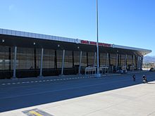
Bingöl Airport opened on 12 July 2013. It has a passenger capacity of 500'000 a year.
Education[]
Bingöl University opened on 29 May 2007.[31] The University continues its activities with 9 faculties, 6 vocational schools and 5 institutes.
Climate[]
Bingöl has a continental climate (Köppen climate classification: Dsa, or Trewartha climate classification: Dca), with hot, dry summers and cold, snowy winters. The driest months are July and August and the wettest is February and December.
| hideClimate data for Bingöl (1991–2020, extremes 1961–2020) | |||||||||||||
|---|---|---|---|---|---|---|---|---|---|---|---|---|---|
| Month | Jan | Feb | Mar | Apr | May | Jun | Jul | Aug | Sep | Oct | Nov | Dec | Year |
| Record high °C (°F) | 13.3 (55.9) |
16.2 (61.2) |
22.3 (72.1) |
30.3 (86.5) |
33.4 (92.1) |
38.0 (100.4) |
42.0 (107.6) |
41.3 (106.3) |
37.8 (100.0) |
32.1 (89.8) |
25.5 (77.9) |
22.8 (73.0) |
42.0 (107.6) |
| Average high °C (°F) | 2.4 (36.3) |
4.1 (39.4) |
10.2 (50.4) |
16.9 (62.4) |
23.1 (73.6) |
29.8 (85.6) |
34.7 (94.5) |
35.1 (95.2) |
29.9 (85.8) |
22.0 (71.6) |
12.7 (54.9) |
5.2 (41.4) |
18.8 (65.8) |
| Daily mean °C (°F) | −2.1 (28.2) |
−0.8 (30.6) |
4.7 (40.5) |
10.9 (51.6) |
16.2 (61.2) |
22.2 (72.0) |
26.7 (80.1) |
26.7 (80.1) |
21.3 (70.3) |
14.5 (58.1) |
6.8 (44.2) |
0.7 (33.3) |
12.3 (54.1) |
| Average low °C (°F) | −5.5 (22.1) |
−4.6 (23.7) |
0.4 (32.7) |
5.8 (42.4) |
10.2 (50.4) |
15.0 (59.0) |
19.3 (66.7) |
19.1 (66.4) |
13.9 (57.0) |
8.6 (47.5) |
2.2 (36.0) |
−2.8 (27.0) |
6.8 (44.2) |
| Record low °C (°F) | −23.2 (−9.8) |
−21.6 (−6.9) |
−20.3 (−4.5) |
−9.2 (15.4) |
1.0 (33.8) |
3.5 (38.3) |
8.8 (47.8) |
7.8 (46.0) |
4.2 (39.6) |
−2.4 (27.7) |
−15.0 (5.0) |
−25.1 (−13.2) |
−25.1 (−13.2) |
| Average precipitation mm (inches) | 138.7 (5.46) |
128.9 (5.07) |
134.4 (5.29) |
110.5 (4.35) |
82.5 (3.25) |
21.3 (0.84) |
6.6 (0.26) |
5.1 (0.20) |
15.4 (0.61) |
65.3 (2.57) |
93.1 (3.67) |
133.3 (5.25) |
935.1 (36.81) |
| Average precipitation days | 10.47 | 10.37 | 13.43 | 15.17 | 14.50 | 5.70 | 1.93 | 1.57 | 3.33 | 8.33 | 8.47 | 11.30 | 104.6 |
| Mean monthly sunshine hours | 105.4 | 124.3 | 148.8 | 165.0 | 213.9 | 270.0 | 285.2 | 275.9 | 240.0 | 189.1 | 135.0 | 102.3 | 2,254.9 |
| Mean daily sunshine hours | 3.4 | 4.4 | 4.8 | 5.5 | 6.9 | 9.0 | 9.2 | 8.9 | 8.0 | 6.1 | 4.5 | 3.3 | 6.2 |
| Source: Turkish State Meteorological Service[32] | |||||||||||||
References[]
- ^ "Area of regions (including lakes), km²". Regional Statistics Database. Turkish Statistical Institute. 2002. Retrieved 5 March 2013.
- ^ "Population of province/district centers and towns/villages by districts - 2012". Address Based Population Registration System (ABPRS) Database. Turkish Statistical Institute. Retrieved 27 February 2013.
- ^ Abdurrahman Yılmaz (2015). "Zazaca - Türkçe sözlük : Genç - Bingöl yöresi" (PDF) (in Zazaki and Turkish): 32. Archived from the original (PDF) on 4 March 2016. Retrieved 29 April 2020. Cite journal requires
|journal=(help) - ^ Adem Avcıkıran (2009). Kürtçe Anamnez Anamneza bi Kurmancî (PDF) (in Turkish and Kurdish). p. 55. Retrieved 17 December 2019.
- ^ Statistical Institute[permanent dead link]
- ^ Oikonomides, Nicolas (1972). Les Listes de Préséance Byzantines des IXe et Xe Siècles (in French). Paris, France: Editions du Centre National de la Recherche Scientifique. p. 359.
- ^ M. Mahfuz, Söylemez (2010). According To The Tahrir Register Dated 1550 Liva Of Çapakçur (PDF). Bingöl. p. 17. ISBN 978-975-6788-82-0.
- ^ Italian City-states and Catholic Missions in Mongolian World of the 13th and 14th Centuries, ANTHROPOLOGIA INTEGRA Vol. 3, No. 2, 2012, p.9; academia.edu
- ^ Bingöl Tarihi, frmartuklu.org
- ^ "Bingöl'de zırhlı polis aracına saldırı: 2 polis şehit, 5'i polis 19 yaralı". www.sozcu.com.tr (in Turkish). Retrieved 28 October 2020.
- ^ DHA. "Bingöl'de PKK pususu: 1 asker şehit, 3 asker yaralı". Hürriyet (in Turkish). Retrieved 28 October 2020.
- ^ Aydan, Ö. (July 2003). "THE BİNGÖL EARTHQUAKE OF MAY 1, 2003" (PDF). Tokai University, Department of Marine Civil Engineering. p. 4.
- ^ Aydan, Ö. (July 2003). "THE BİNGÖL EARTHQUAKE OF MAY 1, 2003" (PDF). Tokai University, Department of Marine Civil Engineering. p. 1.
- ^ "Bingöl'de deprem: Bir güvenlik görevlisi hayatını kaybetti". euronews (in Turkish). 15 June 2020. Retrieved 21 October 2020.
- ^ "1965 genel nüfus sayımı verileri". Türkiye İstatistik Kurumu. Archived from the original on 2 November 2012. Retrieved 3 November 2012.
- ^ "1970 genel nüfus sayımı verileri". Türkiye İstatistik Kurumu. Archived from the original on 3 November 2012. Retrieved 3 November 2012.
- ^ "1975 genel nüfus sayımı verileri". Türkiye İstatistik Kurumu. Archived from the original on 3 November 2012. Retrieved 3 November 2012.
- ^ "1980 genel nüfus sayımı verileri". Türkiye İstatistik Kurumu. Archived from the original on 3 November 2012. Retrieved 3 November 2012.
- ^ "1985 genel nüfus sayımı verileri". Türkiye İstatistik Kurumu. Archived from the original on 3 November 2012. Retrieved 3 November 2012.
- ^ "1990 genel nüfus sayımı verileri". Türkiye İstatistik Kurumu. Archived from the original on 3 November 2012. Retrieved 3 November 2012.
- ^ "2000 genel nüfus sayımı verileri". Türkiye İstatistik Kurumu. Archived from the original on 3 November 2012. Retrieved 3 November 2012.
- ^ "2007 genel nüfus sayımı verileri". Türkiye İstatistik Kurumu. Archived from the original on 3 November 2012. Retrieved 3 November 2012.
- ^ "2008 genel nüfus sayımı verileri". Türkiye İstatistik Kurumu. Archived from the original on 3 November 2012. Retrieved 3 November 2012.
- ^ "2009 genel nüfus sayımı verileri". Türkiye İstatistik Kurumu. Archived from the original on 3 November 2012. Retrieved 3 November 2012.
- ^ "2011 genel nüfus sayımı verileri". Türkiye İstatistik Kurumu. Archived from the original on 3 November 2012. Retrieved 3 November 2012.
- ^ "2012 genel nüfus sayımı verileri". Türkiye İstatistik Kurumu. Archived from the original on 20 February 2013. Retrieved 8 March 2013.
- ^ "2013 genel nüfus sayımı verileri". Türkiye İstatistik Kurumu. Archived from the original on 15 February 2014. Retrieved 15 February 2014.
- ^ "2014 genel nüfus sayımı verileri". Türkiye İstatistik Kurumu. Archived from the original on 10 February 2015. Retrieved 10 February 2015.
- ^ "2015 genel nüfus sayımı verileri" (Doğrudan bir kaynak olmayıp ilgili veriye ulaşmak için sorgulama yapılmalıdır). Türkiye İstatistik Kurumu. Retrieved 13 April 2016.
- ^ "2016 genel nüfus sayımı verileri" (Doğrudan bir kaynak olmayıp ilgili veriye ulaşmak için sorgulama yapılmalıdır). Türkiye İstatistik Kurumu. Retrieved 7 March 2017.
- ^ Bingöl University Archived 11 June 2015 at the Wayback Machine
- ^ "Resmi İstatistikler: İllerimize Ait Mevism Normalleri (1991–2020)" (in Turkish). Turkish State Meteorological Service. Retrieved 27 June 2021.
| show Bingöl in Bingöl Province of Turkey |
|---|

| show Authority control |
|---|
This article about an Eastern Anatolia Region of Turkey location is a stub. You can help Wikipedia by . |
- Cities in Turkey
- Populated places in Bingöl Province
- Districts of Bingöl Province
- Kurdish settlements in Turkey
- Eastern Anatolia Region geography stubs