Crasville-la-Rocquefort
Crasville-la-Rocquefort | |
|---|---|
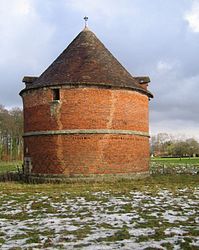 The chateau's dovecote in Crasville-la-Rocquefort | |
Location of Crasville-la-Rocquefort  | |
 Crasville-la-Rocquefort  Crasville-la-Rocquefort | |
| Coordinates: 49°48′20″N 0°52′50″E / 49.8056°N 0.8806°ECoordinates: 49°48′20″N 0°52′50″E / 49.8056°N 0.8806°E | |
| Country | France |
| Region | Normandy |
| Department | Seine-Maritime |
| Arrondissement | Dieppe |
| Canton | Saint-Valery-en-Caux |
| Intercommunality | CC Côte d'Albâtre |
| Government | |
| • Mayor (2020–2026) | Patrice Faucon |
| Area 1 | 5.21 km2 (2.01 sq mi) |
| Population (Jan. 2018)[1] | 211 |
| • Density | 40/km2 (100/sq mi) |
| Time zone | UTC+01:00 (CET) |
| • Summer (DST) | UTC+02:00 (CEST) |
| INSEE/Postal code | 76190 /76740 |
| Elevation | 53–109 m (174–358 ft) (avg. 95 m or 312 ft) |
| 1 French Land Register data, which excludes lakes, ponds, glaciers > 1 km2 (0.386 sq mi or 247 acres) and river estuaries. | |
Crasville-la-Rocquefort is a commune in the Seine-Maritime department in the Normandy region in northern France.
Geography[]
A farming village situated in the Pays de Caux, some 15 miles (24 km) southwest of Dieppe, at the junction of the D108, D437 and the D102 roads.
Population[]
| Year | 1962 | 1968 | 1975 | 1982 | 1990 | 1999 | 2006 |
|---|---|---|---|---|---|---|---|
| Population | 199 | 222 | 223 | 230 | 300 | 269 | 235 |
| From the year 1962 on: No double counting—residents of multiple communes (e.g. students and military personnel) are counted only once. | |||||||
Places of interest[]
- The church of St.Martin, dating from the sixteenth century.
- The chateau, built on the foundations of a feudal castle.
See also[]
- Communes of the Seine-Maritime department
References[]
- ^ "Populations légales 2018". INSEE. 28 December 2020.
| Wikimedia Commons has media related to Crasville-la-Rocquefort. |
Communes of the Seine-Maritime department | |
|---|---|
|
Categories:
- Communes of Seine-Maritime
- Dieppe geography stubs