Fontaine-en-Bray
From Wikipedia, the free encyclopedia
Commune in Normandy, France
Fontaine-en-Bray | |
|---|---|
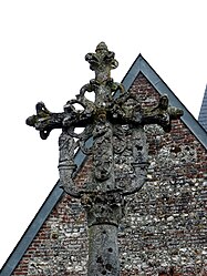 A cross on the church | |
 Fontaine-en-Bray  Fontaine-en-Bray | |
Coordinates:  49°40′34″N 1°25′39″E / 49.6761°N 1.4275°E / 49.6761; 1.4275Coordinates: 49°40′34″N 1°25′39″E / 49.6761°N 1.4275°E / 49.6761; 1.4275 49°40′34″N 1°25′39″E / 49.6761°N 1.4275°E / 49.6761; 1.4275Coordinates: 49°40′34″N 1°25′39″E / 49.6761°N 1.4275°E / 49.6761; 1.4275 | |
| Country | France |
| Region | Normandy |
| Department | Seine-Maritime |
| Arrondissement | Dieppe |
| Canton | Neufchâtel-en-Bray |
| Intercommunality | CC Bray-Eawy |
| Government | |
| • Mayor (2014–2020) | Isabelle Padé |
| Area 1 | 6.03 km2 (2.33 sq mi) |
| Population (Jan. 2018)[1] | 175 |
| • Density | 29/km2 (75/sq mi) |
| Time zone | UTC+01:00 (CET) |
| • Summer (DST) | UTC+02:00 (CEST) |
| INSEE/Postal code | 76269 /76440 |
| Elevation | 100–233 m (328–764 ft) (avg. 132 m or 433 ft) |
| 1 French Land Register data, which excludes lakes, ponds, glaciers > 1 km2 (0.386 sq mi or 247 acres) and river estuaries. | |

Fontaine-en-Bray is a commune in the Seine-Maritime department in the Normandy region in northern France.
Geography[]
A small farming village situated in the Pays de Bray, some 33 miles (53 km) southeast of Dieppe, at the junction of the D1, the D114 and the D119 roads.
Population[]
| Year | 1962 | 1968 | 1975 | 1982 | 1990 | 1999 | 2006 |
|---|---|---|---|---|---|---|---|
| Population | 211 | 204 | 161 | 140 | 164 | 170 | 165 |
| From the year 1962 on: No double counting—residents of multiple communes (e.g. students and military personnel) are counted only once. | |||||||
Places of interest[]
- The eleventh-century church of Saint-Sulpice.
- A sixteenth-century stone cross.
See also[]
- Communes of the Seine-Maritime department
References[]
- ^ "Populations légales 2018". INSEE. 28 December 2020.
| Wikimedia Commons has media related to Fontaine-en-Bray. |
show
Communes of the Seine-Maritime department | |
|---|---|
|
This Dieppe geographical article is a stub. You can help Wikipedia by . |
- v
- t
Retrieved from ""
Categories:
- Communes of Seine-Maritime
- Dieppe geography stubs
Hidden categories:
- Articles with short description
- Short description is different from Wikidata
- Infobox mapframe without OSM relation ID on Wikidata
- Coordinates on Wikidata
- Pages using infobox settlement with image map1 but not image map
- Commons category link from Wikidata
- Articles with BNF identifiers
- All stub articles
- Pages using the Kartographer extension