Criquetot-le-Mauconduit
Criquetot-le-Mauconduit | |
|---|---|
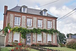 The town hall in Criquetot-le-Mauconduit | |
show Location of Criquetot-le-Mauconduit | |
 Criquetot-le-Mauconduit | |
| Coordinates: 49°47′38″N 0°33′43″E / 49.7939°N 0.5619°ECoordinates: 49°47′38″N 0°33′43″E / 49.7939°N 0.5619°E | |
| Country | France |
| Region | Normandy |
| Department | Seine-Maritime |
| Arrondissement | Le Havre |
| Canton | Fécamp |
| Intercommunality | CC Côte d'Albâtre |
| Area 1 | 4.12 km2 (1.59 sq mi) |
| Population (Jan. 2018)[1] | 175 |
| • Density | 42/km2 (110/sq mi) |
| Time zone | UTC+01:00 (CET) |
| • Summer (DST) | UTC+02:00 (CEST) |
| INSEE/Postal code | 76195 /76540 |
| Elevation | 64–113 m (210–371 ft) (avg. 100 m or 330 ft) |
| 1 French Land Register data, which excludes lakes, ponds, glaciers > 1 km2 (0.386 sq mi or 247 acres) and river estuaries. | |


Criquetot-le-Mauconduit is a commune in the Seine-Maritime department in the Normandy region in northern France.
The inhabitants of the town of Criquetot le Mauconduit are "Criquetot Criquetotaises"[2]
Geography[]
A small farming village situated in the Pays de Caux, some 29 miles (47 km) northeast of Le Havre, at the junction of the D479 and D471 roads.
Population[]
| Year | 1962 | 1968 | 1975 | 1982 | 1990 | 1999 | 2006 |
|---|---|---|---|---|---|---|---|
| Population | 163 | 163 | 123 | 118 | 142 | 130 | 161 |
| From the year 1962 on: No double counting—residents of multiple communes (e.g. students and military personnel) are counted only once. | |||||||
Places of interest[]
- The church of St. Rémy, dating from the twelfth century.
See also[]
- Communes of the Seine-Maritime department
References[]
- ^ "Populations légales 2018". INSEE. 28 December 2020.
- ^ "Communes"
| Wikimedia Commons has media related to Criquetot-le-Mauconduit. |
| show Communes of the Seine-Maritime department |
|---|
Categories:
- Communes of Seine-Maritime
- Le Havre geography stubs