Freneuse, Seine-Maritime
From Wikipedia, the free encyclopedia
Commune in Normandy, France
Freneuse | |
|---|---|
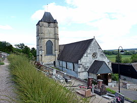 The church in Freneuse | |
 Freneuse  Freneuse | |
Coordinates:  49°18′32″N 1°03′51″E / 49.3089°N 1.0642°E / 49.3089; 1.0642Coordinates: 49°18′32″N 1°03′51″E / 49.3089°N 1.0642°E / 49.3089; 1.0642 49°18′32″N 1°03′51″E / 49.3089°N 1.0642°E / 49.3089; 1.0642Coordinates: 49°18′32″N 1°03′51″E / 49.3089°N 1.0642°E / 49.3089; 1.0642 | |
| Country | France |
| Region | Normandy |
| Department | Seine-Maritime |
| Arrondissement | Rouen |
| Canton | Caudebec-lès-Elbeuf |
| Intercommunality | Métropole Rouen Normandie |
| Government | |
| • Mayor (2020–2026) | Pascal Baron |
| Area 1 | 3.18 km2 (1.23 sq mi) |
| Population (Jan. 2018)[1] | 951 |
| • Density | 300/km2 (770/sq mi) |
| Time zone | UTC+01:00 (CET) |
| • Summer (DST) | UTC+02:00 (CEST) |
| INSEE/Postal code | 76282 /76410 |
| Elevation | 3–75 m (9.8–246.1 ft) (avg. 11 m or 36 ft) |
| 1 French Land Register data, which excludes lakes, ponds, glaciers > 1 km2 (0.386 sq mi or 247 acres) and river estuaries. | |

Freneuse is a commune in the Seine-Maritime department in the Normandy region in northern France.
Geography[]
A farming village situated in a meander of the river Seine some 8 miles (13 km) south of the centre of Rouen, at the junction of the D92 and the D292 roads.
Population[]
| Year | 1962 | 1968 | 1975 | 1982 | 1990 | 1999 | 2006 |
|---|---|---|---|---|---|---|---|
| Population | 560 | 575 | 730 | 1024 | 1033 | 951 | 948 |
| From the year 1962 on: No double counting—residents of multiple communes (e.g. students and military personnel) are counted only once. | |||||||
Places of interest[]
- The church of Notre-Dame, dating from the sixteenth century.
- The chateau at the hamlet of Beaudoin.
- The seventeenth-century chateau du Val-Freneuse
See also[]
- Communes of the Seine-Maritime department
References[]
- ^ "Populations légales 2018". INSEE. 28 December 2020.
| Wikimedia Commons has media related to Freneuse (Seine-Maritime). |
show
Communes of the Seine-Maritime department | |
|---|---|
|
This Rouen geographical article is a stub. You can help Wikipedia by . |
- v
- t
Retrieved from ""
Categories:
- Communes of Seine-Maritime
- Rouen geography stubs
Hidden categories:
- Articles with short description
- Short description is different from Wikidata
- Infobox mapframe without OSM relation ID on Wikidata
- Coordinates on Wikidata
- Pages using infobox settlement with image map1 but not image map
- Commons category link is on Wikidata
- Articles with BNF identifiers
- All stub articles
- Pages using the Kartographer extension