Préaux, Seine-Maritime
Préaux | |
|---|---|
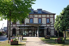 The town hall in Préaux | |
 Coat of arms | |
show Location of Préaux | |
 Préaux | |
| Coordinates: 49°29′31″N 1°12′52″E / 49.4919°N 1.2144°ECoordinates: 49°29′31″N 1°12′52″E / 49.4919°N 1.2144°E | |
| Country | France |
| Region | Normandy |
| Department | Seine-Maritime |
| Arrondissement | Rouen |
| Canton | Le Mesnil-Esnard |
| Intercommunality | CC Inter-Caux-Vexin |
| Government | |
| • Mayor (2020–2026) | Gérard Moreau[1] |
| Area 1 | 18.95 km2 (7.32 sq mi) |
| Population (Jan. 2018)[2] | 1,816 |
| • Density | 96/km2 (250/sq mi) |
| Time zone | UTC+01:00 (CET) |
| • Summer (DST) | UTC+02:00 (CEST) |
| INSEE/Postal code | 76509 /76160 |
| Elevation | 80–176 m (262–577 ft) (avg. 170 m or 560 ft) |
| 1 French Land Register data, which excludes lakes, ponds, glaciers > 1 km2 (0.386 sq mi or 247 acres) and river estuaries. | |


Préaux (French pronunciation: [pʁeo]) is a commune in the Seine-Maritime department in the Normandy region in northern France.
Geography[]
A farming village situated some 9 miles (14 km) northeast of Rouen at the junction of the D6015, D47 and the D104 roads. The A151 autoroute passes through the commune's territory.
Heraldry[]
 |
The arms of Préaux are blazoned : Gules, 4 pales argent, overall a double-headed eagle Or, langued of the field, heads and feet azure.
|
Population[]
| Year | Pop. | ±% p.a. |
|---|---|---|
| 1968 | 611 | — |
| 1975 | 822 | +4.33% |
| 1982 | 1,105 | +4.32% |
| 1990 | 1,450 | +3.45% |
| 1999 | 1,641 | +1.38% |
| 2007 | 1,649 | +0.06% |
| 2012 | 1,699 | +0.60% |
| 2017 | 1,812 | +1.30% |
| Source: INSEE[3] | ||
Places of interest[]
- The church of Notre-Dame, dating from the eighteenth century.
- Ruins of a thirteenth-century castle.
See also[]
- Communes of the Seine-Maritime department
References[]
- ^ Liste des maires du département de la Seine-Maritime, 10 August 2020
- ^ "Populations légales 2018". INSEE. 28 December 2020.
- ^ Population en historique depuis 1968, INSEE
| Wikimedia Commons has media related to Préaux (Seine-Maritime). |
| show Communes of the Seine-Maritime department |
|---|
Categories:
- Communes of Seine-Maritime
- Rouen geography stubs