Groises
Groises | |
|---|---|
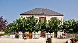 The town hall in Groises | |
show Location of Groises | |
 Groises | |
| Coordinates: 47°12′36″N 2°48′38″E / 47.21°N 2.8106°ECoordinates: 47°12′36″N 2°48′38″E / 47.21°N 2.8106°E | |
| Country | France |
| Region | Centre-Val de Loire |
| Department | Cher |
| Arrondissement | Bourges |
| Canton | Avord |
| Government | |
| • Mayor (2020–2026) | Marie-Pierre Verneau |
| Area 1 | 17.63 km2 (6.81 sq mi) |
| Population (Jan. 2018)[1] | 132 |
| • Density | 7.5/km2 (19/sq mi) |
| Time zone | UTC+01:00 (CET) |
| • Summer (DST) | UTC+02:00 (CEST) |
| INSEE/Postal code | 18104 /18140 |
| Elevation | 167–208 m (548–682 ft) (avg. 183 m or 600 ft) |
| 1 French Land Register data, which excludes lakes, ponds, glaciers > 1 km2 (0.386 sq mi or 247 acres) and river estuaries. | |


Groises (French pronunciation: [ɡʁwaz]) is a commune in the Cher department in the Centre-Val de Loire region of France.
Geography[]
A farming area comprising a small village and a couple of hamlets situated by the banks of the river Chantraine, some 20 miles (32 km) northeast of Bourges, at the junction of the D10, D44 and the D51 roads.
Population[]
| Year | Pop. | ±% |
|---|---|---|
| 1962 | 204 | — |
| 1968 | 237 | +16.2% |
| 1975 | 225 | −5.1% |
| 1982 | 197 | −12.4% |
| 1990 | 155 | −21.3% |
| 1999 | 138 | −11.0% |
| 2008 | 141 | +2.2% |
Sights[]
- The church of St. Martin, dating from the twelfth century.
See also[]
- Communes of the Cher department
References[]
- ^ "Populations légales 2018". INSEE. 28 December 2020.
| Wikimedia Commons has media related to Groises. |
| show Communes of the Cher department |
|---|
Categories:
- Communes of Cher (department)