Précy
Précy | |
|---|---|
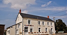 The town hall in Précy | |
show Location of Précy | |
 Précy | |
| Coordinates: 47°06′01″N 2°55′47″E / 47.1003°N 2.9297°ECoordinates: 47°06′01″N 2°55′47″E / 47.1003°N 2.9297°E | |
| Country | France |
| Region | Centre-Val de Loire |
| Department | Cher |
| Arrondissement | Bourges |
| Canton | Avord |
| Government | |
| • Mayor (2020–2026) | Joël Vignel[1] |
| Area 1 | 14.45 km2 (5.58 sq mi) |
| Population (Jan. 2018)[2] | 347 |
| • Density | 24/km2 (62/sq mi) |
| Time zone | UTC+01:00 (CET) |
| • Summer (DST) | UTC+02:00 (CEST) |
| INSEE/Postal code | 18184 /18140 |
| Elevation | 168–197 m (551–646 ft) (avg. 150 m or 490 ft) |
| 1 French Land Register data, which excludes lakes, ponds, glaciers > 1 km2 (0.386 sq mi or 247 acres) and river estuaries. | |


Précy is a commune in the Cher department in the Centre-Val de Loire region of France.
Geography[]
An area of forestry and farming comprising the village and a couple of hamlets situated some 23 miles (37 km) east of Bourges, at the junction of the D51, D920, D48 and the D81 roads. The river Vauvise forms all of the commune's northern boundary.
Population[]
| Year | Pop. | ±% |
|---|---|---|
| 1962 | 320 | — |
| 1968 | 372 | +16.3% |
| 1975 | 285 | −23.4% |
| 1982 | 262 | −8.1% |
| 1990 | 301 | +14.9% |
| 1999 | 312 | +3.7% |
| 2008 | 336 | +7.7% |
Sights[]
- The church of St. Louis, dating from the sixteenth century.
- A feudal motte at the place known as Château de Faye.
- A seventeenth-century chateau.
- A converted watermill.
See also[]
- Communes of the Cher department
References[]
- ^ "Répertoire national des élus: les maires". data.gouv.fr, Plateforme ouverte des données publiques françaises (in French). 2 December 2020.
- ^ "Populations légales 2018". INSEE. 28 December 2020.
| Wikimedia Commons has media related to Précy. |
| show Communes of the Cher department |
|---|
Categories:
- Communes of Cher (department)