Quincy, Cher
Quincy | |
|---|---|
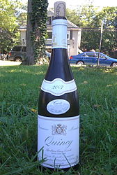 A 2007 bottle of Quincy AOC white wine | |
show Location of Quincy | |
 Quincy | |
| Coordinates: 47°08′03″N 2°09′28″E / 47.1342°N 2.1578°ECoordinates: 47°08′03″N 2°09′28″E / 47.1342°N 2.1578°E | |
| Country | France |
| Region | Centre-Val de Loire |
| Department | Cher |
| Arrondissement | Vierzon |
| Canton | Mehun-sur-Yèvre |
| Intercommunality | CC Cœur de Berry |
| Government | |
| • Mayor (2008–2014) | Claude Derbez |
| Area 1 | 18.19 km2 (7.02 sq mi) |
| Population (Jan. 2018)[1] | 859 |
| • Density | 47/km2 (120/sq mi) |
| Time zone | UTC+01:00 (CET) |
| • Summer (DST) | UTC+02:00 (CEST) |
| INSEE/Postal code | 18190 /18120 |
| Elevation | 103–136 m (338–446 ft) (avg. 130 m or 430 ft) |
| 1 French Land Register data, which excludes lakes, ponds, glaciers > 1 km2 (0.386 sq mi or 247 acres) and river estuaries. | |


Quincy is a commune in the Cher department in the Centre-Val de Loire region of France.
Geography[]
Quincy is a village located at 10 km of Vierzon and Bourges. Mehun-sur-Yèvre (5000 inhabitants) is a medium-size town located near Quincy. It is famous for its castle, built by King Charles VII. The river Cher flows through Quincy.
A valley area of lakes, woods and farming comprising the village and a couple of hamlets, situated by the river Cher, some 9 miles (14 km) southeast of Vierzon at the junction of the D27 and the D20 roads.
Population[]
| Year | Pop. | ±% |
|---|---|---|
| 1962 | 714 | — |
| 1968 | 727 | +1.8% |
| 1975 | 783 | +7.7% |
| 1982 | 759 | −3.1% |
| 1990 | 812 | +7.0% |
| 1999 | 775 | −4.6% |
| 2008 | 833 | +7.5% |
Sights[]
- The church of St. Germain, dating from the eighteenth century.
- The eighteenth-century chateau.
See also[]
- Communes of the Cher department
References[]
- ^ "Populations légales 2018". INSEE. 28 December 2020.
External links[]
 Media related to Quincy (Cher) at Wikimedia Commons
| show Communes of the Cher department |
|---|
Categories:
- Communes of Cher (department)