Gron, Cher
Gron | |
|---|---|
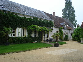 Farmhouse | |
show Location of Gron | |
 Gron | |
| Coordinates: 47°07′20″N 2°44′31″E / 47.1222°N 2.7419°ECoordinates: 47°07′20″N 2°44′31″E / 47.1222°N 2.7419°E | |
| Country | France |
| Region | Centre-Val de Loire |
| Department | Cher |
| Arrondissement | Bourges |
| Canton | Avord |
| Intercommunality | CC La Septaine |
| Government | |
| • Mayor (2020–2026) | Jean Moinet |
| Area 1 | 26.22 km2 (10.12 sq mi) |
| Population (Jan. 2018)[1] | 458 |
| • Density | 17/km2 (45/sq mi) |
| Time zone | UTC+01:00 (CET) |
| • Summer (DST) | UTC+02:00 (CEST) |
| INSEE/Postal code | 18105 /18800 |
| Elevation | 167–263 m (548–863 ft) |
| 1 French Land Register data, which excludes lakes, ponds, glaciers > 1 km2 (0.386 sq mi or 247 acres) and river estuaries. | |


Gron (French pronunciation: [ɡʁɔ̃]) is a commune in the Cher department in the Centre-Val de Loire region of France.
Geography[]
An area of forestry and farming, comprising the village and several hamlets situated by the banks of the Yèvre river, some 14 miles (23 km) east of Bourges, at the junction of the D10, D93 and the N151 roads. The commune lies on the pilgrimage route known as St. James' Way.
Population[]
| Year | Pop. | ±% |
|---|---|---|
| 1962 | 389 | — |
| 1968 | 483 | +24.2% |
| 1975 | 365 | −24.4% |
| 1982 | 302 | −17.3% |
| 1990 | 341 | +12.9% |
| 1999 | 426 | +24.9% |
| 2008 | 455 | +6.8% |
Sights[]
- The church of St. Etienne, dating from the twelfth century.
- The fifteenth-century chateau du Coupoy.
- A mill.
See also[]
- Communes of the Cher department
References[]
- ^ "Populations légales 2018". INSEE. 28 December 2020.
| Wikimedia Commons has media related to Gron (Cher). |
| show Communes of the Cher department |
|---|
Categories:
- Communes of Cher (department)