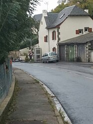
Le Cayrol
show This article may be expanded with text translated from the corresponding article in French. (December 2008) Click [show] for important translation instructions. |
Le Cayrol | |
|---|---|
 Street art Scarecrow in October 2015 | |
show Location of Le Cayrol | |
 Le Cayrol | |
| Coordinates: 44°35′17″N 2°47′34″E / 44.5881°N 2.7928°ECoordinates: 44°35′17″N 2°47′34″E / 44.5881°N 2.7928°E | |
| Country | France |
| Region | Occitanie |
| Department | Aveyron |
| Arrondissement | Rodez |
| Canton | Lot et Truyère |
| Government | |
| • Mayor (2020–2026) | Bernard Valery |
| Area 1 | 22.16 km2 (8.56 sq mi) |
| Population (Jan. 2018)[1] | 262 |
| • Density | 12/km2 (31/sq mi) |
| Time zone | UTC+01:00 (CET) |
| • Summer (DST) | UTC+02:00 (CEST) |
| INSEE/Postal code | 12064 /12500 |
| Elevation | 470–885 m (1,542–2,904 ft) (avg. 856 m or 2,808 ft) |
| 1 French Land Register data, which excludes lakes, ponds, glaciers > 1 km2 (0.386 sq mi or 247 acres) and river estuaries. | |


Le Cayrol (French pronunciation: [lə kɛʁɔl]; Occitan: Lo Cairòl) is a commune in the Aveyron department in southern France.
Population[]
| Year | Pop. | ±% |
|---|---|---|
| 1962 | 412 | — |
| 1968 | 442 | +7.3% |
| 1975 | 416 | −5.9% |
| 1982 | 328 | −21.2% |
| 1990 | 313 | −4.6% |
| 1999 | 282 | −9.9% |
| 2008 | 285 | +1.1% |
See also[]
References[]
- ^ "Populations légales 2018". INSEE. 28 December 2020.
| Wikimedia Commons has media related to Le Cayrol. |
This Aveyron geographical article is a stub. You can help Wikipedia by . |
Categories:
- Communes of Aveyron
- Aveyron geography stubs