Saint-Laurent-d'Olt
show This article may be expanded with text translated from the corresponding article in French. (January 2019) Click [show] for important translation instructions. |
Saint-Laurent-d'Olt | |
|---|---|
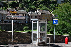 Street furniture in Saint-Laurent-d'Olt | |
 Coat of arms | |
show Location of Saint-Laurent-d'Olt | |
 Saint-Laurent-d'Olt | |
| Coordinates: 44°26′49″N 3°06′42″E / 44.4469°N 3.1117°ECoordinates: 44°26′49″N 3°06′42″E / 44.4469°N 3.1117°E | |
| Country | France |
| Region | Occitanie |
| Department | Aveyron |
| Arrondissement | Rodez |
| Canton | Tarn et Causses |
| Government | |
| • Mayor (2020–2026) | Alain Vioulac[1] |
| Area 1 | 38.74 km2 (14.96 sq mi) |
| Population (Jan. 2018)[2] | 645 |
| • Density | 17/km2 (43/sq mi) |
| Time zone | UTC+01:00 (CET) |
| • Summer (DST) | UTC+02:00 (CEST) |
| INSEE/Postal code | 12237 /12560 |
| Elevation | 448–1,033 m (1,470–3,389 ft) (avg. 545 m or 1,788 ft) |
| 1 French Land Register data, which excludes lakes, ponds, glaciers > 1 km2 (0.386 sq mi or 247 acres) and river estuaries. | |


Saint-Laurent-d'Olt is a commune in the Aveyron department in southern France.
Geography[]
Situated on the D988 departmental road, roughly equidistant between the towns of Millau, Rodez and Mende, and 3.5 km west of the A75 autoroute, Saint-Laurent-d'Olt is perched on a rocky ridge above the Lot River, at about 584 metres above sea level. The upper valley of the Lot divides the volcanic plateau of the Aubrac from the limestone plateaux of the Grands Causses.
In order to preserve the biodiversity of the area, the upper Lot valley between Espalion and Saint-Laurent-d'Olt is gazetted as part of the Natura 2000 network.
The commune is also part of the .
Institut Médico-Educatif (I.M.E.)[]
As well as providing services for the surrounding district, the village is home to an Institut Médico-Educatif, which is a residential school for children with intellectual handicaps, aged 6–20. The current roll is around 80 pupils. Founded in 1965, the Institut is the largest employer in the commune, employing 60 people.[3]
Population[]
| Year | Pop. | ±% |
|---|---|---|
| 1962 | 731 | — |
| 1968 | 745 | +1.9% |
| 1975 | 728 | −2.3% |
| 1982 | 658 | −9.6% |
| 1990 | 659 | +0.2% |
| 1999 | 619 | −6.1% |
| 2008 | 661 | +6.8% |
See also[]
References[]
- ^ "Répertoire national des élus: les maires". data.gouv.fr, Plateforme ouverte des données publiques françaises (in French). 2 December 2020.
- ^ "Populations légales 2018". INSEE. 28 December 2020.
- ^ http://www.saintlaurentdolt.fr/Ecole.aspx
External links[]
| Wikimedia Commons has media related to Saint-Laurent-d'Olt. |
This Aveyron geographical article is a stub. You can help Wikipedia by . |
- Communes of Aveyron
- Aveyron geography stubs