Saint-André-de-Najac
show This article may be expanded with text translated from the corresponding article in French. (December 2008) Click [show] for important translation instructions. |
Saint-André-de-Najac | |
|---|---|
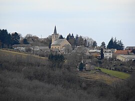 A general view of Saint-André-de-Najac | |
show Location of Saint-André-de-Najac | |
 Saint-André-de-Najac | |
| Coordinates: 44°11′26″N 2°02′28″E / 44.1906°N 2.0411°ECoordinates: 44°11′26″N 2°02′28″E / 44.1906°N 2.0411°E | |
| Country | France |
| Region | Occitanie |
| Department | Aveyron |
| Arrondissement | Villefranche-de-Rouergue |
| Canton | Aveyron et Tarn |
| Government | |
| • Mayor (2008–2014) | André Dalet |
| Area 1 | 25.1 km2 (9.7 sq mi) |
| Population (Jan. 2018)[1] | 457 |
| • Density | 18/km2 (47/sq mi) |
| Time zone | UTC+01:00 (CET) |
| • Summer (DST) | UTC+02:00 (CEST) |
| INSEE/Postal code | 12210 /12270 |
| Elevation | 150–437 m (492–1,434 ft) (avg. 374 m or 1,227 ft) |
| 1 French Land Register data, which excludes lakes, ponds, glaciers > 1 km2 (0.386 sq mi or 247 acres) and river estuaries. | |


Saint-André-de-Najac is a commune in the Aveyron department in southern France.
Population[]
| Year | Pop. | ±% |
|---|---|---|
| 1962 | 475 | — |
| 1968 | 550 | +15.8% |
| 1975 | 540 | −1.8% |
| 1982 | 509 | −5.7% |
| 1990 | 426 | −16.3% |
| 1999 | 373 | −12.4% |
| 2008 | 418 | +12.1% |
Inhabitants are called Saint-Andréens.
See also[]
References[]
- ^ "Populations légales 2018". INSEE. 28 December 2020.
External links[]
| Wikimedia Commons has media related to Saint-André-de-Najac. |
| show Authority control |
|---|
This Aveyron geographical article is a stub. You can help Wikipedia by . |
Categories:
- Communes of Aveyron
- Aveyron geography stubs