Sauclières
show This article may be expanded with text translated from the corresponding article in French. (December 2008) Click [show] for important translation instructions. |
Sauclières | |
|---|---|
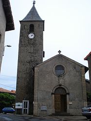 The church in Sauclières | |
show Location of Sauclières | |
 Sauclières | |
| Coordinates: 43°58′37″N 3°22′04″E / 43.9769°N 3.3678°ECoordinates: 43°58′37″N 3°22′04″E / 43.9769°N 3.3678°E | |
| Country | France |
| Region | Occitanie |
| Department | Aveyron |
| Arrondissement | Millau |
| Canton | Causses-Rougiers |
| Government | |
| • Mayor (2008–2014) | Daniel Atcher |
| Area 1 | 38.81 km2 (14.98 sq mi) |
| Population (Jan. 2018)[1] | 169 |
| • Density | 4.4/km2 (11/sq mi) |
| Time zone | UTC+01:00 (CET) |
| • Summer (DST) | UTC+02:00 (CEST) |
| INSEE/Postal code | 12260 /12230 |
| Elevation | 580–1,341 m (1,903–4,400 ft) (avg. 750 m or 2,460 ft) |
| 1 French Land Register data, which excludes lakes, ponds, glaciers > 1 km2 (0.386 sq mi or 247 acres) and river estuaries. | |


Sauclières is a commune in the Aveyron department in southern France.
Population[]
| Year | Pop. | ±% |
|---|---|---|
| 1962 | 205 | — |
| 1968 | 242 | +18.0% |
| 1975 | 198 | −18.2% |
| 1982 | 173 | −12.6% |
| 1990 | 202 | +16.8% |
| 1999 | 189 | −6.4% |
| 2008 | 189 | +0.0% |
See also[]
References[]
- ^ "Populations légales 2018". INSEE. 28 December 2020.
| Wikimedia Commons has media related to Sauclières. |
This Aveyron geographical article is a stub. You can help Wikipedia by . |
Categories:
- Communes of Aveyron
- Aveyron geography stubs