San Pablo, Laguna
This article needs additional citations for verification. (June 2011) |
San Pablo
San Pablo de los Montes | |
|---|---|
Component city | |
| City of San Pablo | |
     Clockwise from top: Lake Pandin, Lake Sampaloc, City Hall, San Pablo Cathedral, Jose Rizal Avenue | |
 Seal | |
| Nickname(s): | |
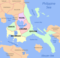
 Map of Laguna with San Pablo highlighted | |
OpenStreetMap  | |
 San Pablo Location within the Philippines | |
| Coordinates: 14°04′12″N 121°19′30″E / 14.07°N 121.325°ECoordinates: 14°04′12″N 121°19′30″E / 14.07°N 121.325°E | |
| Country | Philippines |
| Region | Calabarzon |
| Province | Laguna |
| District | 3rd district |
| Founded | 1586 |
| Chartered | 1647 |
| Cityhood | May 7, 1940 |
| Named for | St. Paul the First Hermit |
| Barangays | 80 (see Barangays) |
| Government | |
| • Type | Sangguniang Panlungsod |
| • Mayor | Loreto S. Amante |
| • Vice Mayor | Justin G. Colago |
| • Representative | Marisol Aragones-Sampelo |
| • City Council | Members |
| • Electorate | 142,997 voters (2019) |
| Area | |
| • Total | 197.56 km2 (76.28 sq mi) |
| Elevation | 237 m (778 ft) |
| Highest elevation | 2,173 m (7,129 ft) |
| Lowest elevation | 2 m (7 ft) |
| Population (2020 census) [3] | |
| • Total | 285,348 |
| • Density | 1,400/km2 (3,700/sq mi) |
| • Households | 60,788 |
| Economy | |
| • Income class | 1st city income class |
| • Poverty incidence | 2.10% (2018)[4] |
| • Revenue | ₱1,426,935,808.17 (2020) |
| • Assets | ₱3,002,845,127.34 (2020) |
| • Expenditure | ₱1,348,913,322.65 (2020) |
| • Liabilities | ₱364,063,362.22 (2020) |
| Service provider | |
| • Electricity | Manila Electric Company (Meralco) |
| Time zone | UTC+8 (PST) |
| ZIP code | 4000 |
| PSGC | |
| IDD : area code | +63 (0)49 |
| Native languages | Tagalog |
San Pablo, officially the City of San Pablo (Tagalog: Lungsod ng San Pablo), is a 1st class component city in the province of Laguna, Philippines. According to the 2020 census, it has a population of 285,348 people. [3]
Located in the southern portion of Laguna province, it is one of the oldest cities in the Philippines. By land area, it is the largest in the province of Laguna. Its population ranks sixth within the province after the cities of Calamba, Santa Rosa, Biñan, San Pedro, and Cabuyao.
The city is more popularly known as the "City of Seven Lakes" (Tagalog: Lungsod ng Pitong Lawa), referring to the Seven Lakes of San Pablo: Lake Sampaloc (or Sampalok), Lake Palakpakin, Lake Bunot, Lakes Pandin and Yambo, Lake Muhikap, and Lake Calibato.
San Pablo was part of the Roman Catholic Archdiocese of Lipa since 1910. On November 28, 1967, it became an independent diocese and became the Roman Catholic Diocese of San Pablo.
History[]

San Pablo's earliest historical record dates back to pre-Spanish times when four large barrios bounded by Mount Makiling composed "Sampalok". In 1571, the first Spanish troops under Captain Juan de Salcedo arrived in the upland village of Sampaloc, which became a parish in 1586, and then a municipality in 1647, and was renamed "San Pablo de Los Montes" in honor of Saint Paul the First Hermit. In 1756, it was placed under the jurisdiction of Batangas province but was returned in 1883 to Laguna.
In 1899, a municipal government was established, with Atty as municipal president. was elected municipal president in 1902 when the civil government was set up. From 1926 to 1940, the people of San Pablo worked for its independence from the province of Laguna. On May 7, 1940, the Charter Bill sponsored by Assemblyman Tomas D. Dizon was approved by president Manuel L. Quezon. The bill became known as the City Charter of San Pablo or Commonwealth Act No. 520 – approved by president Manuel L. Quezon.
The city was inaugurated on March 30, 1941, with Dr. Potenciano Malvar, a former governor of Laguna, as the city mayor appointed by president Manuel L. Quezon. Succeeding him 1941 as an appointed mayor was Dr. Manuel Quisumbing, in turn followed by Tomas D. Dizon in 1943 as an appointed mayor. The succeeding mayors were elected after 1955.
Historical milestones[]
- 1571 – Arrival of Spanish troops under Juan de Salcedo in the village of Sampalok (Sampaloc).
- 1586 – Sampalok (Sampaloc) was converted into a parish.
- 1647 – Sampalok (Sampaloc) was converted to a municipality and renamed "San Pablo de los Montes". , the first governadorcillo
- 1734 – San Pablo parish was under the control of the Franciscans.
- 1756 – Placed under the jurisdiction of Batangas Province.
- 1883 – Returned to Laguna Province.
- 1902 – Innocentes Martinez, first appointed municipal president and Don Marcos Paulino was elected first municipal president under American Period.
- 1940 – Approval of Commonwealth (Act) 520 or Charter of the City of San Pablo with Dr. Potenciano Malvar as first appointed city mayor.
- 1955 – Installed its first elected city mayor Cipriano B. Colago.
- Middle of 20th century – Marked the beginning era of the municipality to a first class city in Laguna characterized by many commercial developments and nature developments of numerous areas. Its conversion to resorts and recreation places, both for local and international tourism.
Geography[]
San Pablo has a cool climate owing to its location. It is nestled in the foothills of three mountains: Mount Banahaw, Mount Makiling and the Sierra Madre Mountains. These mountains do not only provide attractions for the tourism industry (such as waterfalls) and sources of many forest-based products, but also serve as stewards for the clean air. It is situated 82 kilometres (51 mi) southeast of Manila via Alaminos, Laguna, 35 kilometres (22 mi) southwest of Santa Cruz, Laguna via Calauan, Laguna and 50 kilometres (31 mi) northwest of Lucena City, Quezon.
Its soil is suitable for those seeking opportunities in agriculture and horticulture given its richness and fertility. The different barangays have coconut plantation, lanzones fruit – Lansium parasiticum tree plantation and rambutan fruit tree plantation – Rambutan. The place is rich in orchid plants.
Climate[]
The prevailing climatic conditions in the municipality is categorized into wet and dry seasons.
| Climate data for San Pablo City, Laguna | |||||||||||||
|---|---|---|---|---|---|---|---|---|---|---|---|---|---|
| Month | Jan | Feb | Mar | Apr | May | Jun | Jul | Aug | Sep | Oct | Nov | Dec | Year |
| Average high °C (°F) | 26 (79) |
27 (81) |
29 (84) |
31 (88) |
31 (88) |
30 (86) |
29 (84) |
28 (82) |
28 (82) |
28 (82) |
28 (82) |
26 (79) |
28 (83) |
| Average low °C (°F) | 20 (68) |
20 (68) |
20 (68) |
21 (70) |
23 (73) |
24 (75) |
23 (73) |
23 (73) |
23 (73) |
22 (72) |
22 (72) |
21 (70) |
22 (71) |
| Average precipitation mm (inches) | 52 (2.0) |
35 (1.4) |
27 (1.1) |
27 (1.1) |
82 (3.2) |
124 (4.9) |
163 (6.4) |
144 (5.7) |
145 (5.7) |
141 (5.6) |
100 (3.9) |
102 (4.0) |
1,142 (45) |
| Average rainy days | 12.0 | 8.1 | 8.8 | 9.7 | 17.9 | 22.6 | 26.2 | 24.5 | 24.6 | 22.0 | 16.7 | 14.9 | 208 |
| Source: Meteoblue (modeled/calculated data, not measured locally) [5] | |||||||||||||
Barangays[]
San Pablo City is politically subdivided into 80 barangays.
- I-A (Sambat)
- I-B
- II-A (Triangulo)
- II-B (Guadalupe)
- II-C (Unson)
- II-D (Bulante)
- II-F (Villa Rey)
- III-A (Hermanos Belen)
- III-B
- III-C (Labak/De Roma)
- III-D (Villongco)
- III-E
- III-F (Balagtas)
- IV-A
- IV-B
- IV-C
- V-A
- V-B
- V-C
- V-D
- VI-A (Mavenida)
- VI-B
- VI-D (Lparkers)
- VI-E (YMCA)
- VII-A (P.Alcantara)
- VII-B
- VII-D
- VII-E
- Atisan
- Bagong Bayan (I-C)
- Bagong Pook (VI-C)
- Bautista
- Concepcion (Bunot)
- Del Remedio (Wawa)
- San Antonio 1 (Balanga)
- San Antonio 2 (Sapa)
- San Bartolome (Matang-ag)
- (Palakpakin)
- (Lumbangan)
- San Cristobal
- San Diego (Tiim)
- San Francisco (Calihan)
- San Gabriel (Butucan)
- San Gregorio
- San Ignacio
- San Isidro (Balagbag)
- San Joaquin
- San Jose (Malamig)
- San Juan
- San Lorenzo (Saluyan)
- San Lucas 1 (Malinaw)
- San Lucas 2
- San Marcos (Tikew)
- San Mateo
- San Miguel
- San Rafael
- San Roque (Buluburan)
- San Vicente
- Santa Ana
- (Sandig)
- Santa Cruz (Putol)
- Santa Elena
- Santa Filomena (Banlagin)
- Santa Isabel
- Santa Maria
- Santa Maria Magdalena (Boe)
- Santa Monica
- (Bae)
- Santiago I (Bulaho)
- Santiago II
- Santisimo Rosario
- Santo Angel (Ilog)
- Santo Cristo
- Santo Niño (Arsum)
- Soledad (Macopa)
Demographics[]
| Year | Pop. | ±% p.a. |
|---|---|---|
| 1903 | 22,612 | — |
| 1918 | 31,399 | +2.21% |
| 1939 | 46,311 | +1.87% |
| 1948 | 50,435 | +0.95% |
| 1960 | 70,680 | +2.85% |
| 1970 | 105,517 | +4.08% |
| 1975 | 116,607 | +2.02% |
| 1980 | 131,655 | +2.46% |
| 1990 | 161,630 | +2.07% |
| 1995 | 183,757 | +2.43% |
| 2000 | 207,927 | +2.68% |
| 2007 | 237,259 | +1.84% |
| 2010 | 248,890 | +1.76% |
| 2015 | 266,068 | +1.28% |
| 2020 | 285,348 | +1.39% |
| Source: Philippine Statistics Authority [6] [7] [8][9] | ||
According to the 2010 census, it had a population of 248,890 people,[10] up from 237,259 people and 44,166 households in the 2007 census.Recently, owing its proximity in Metro Manila, it was overtaken by Calamba in the 1990 census. San Pedro followed suit in 1995, then comes Santa Rosa and Biñan in 2007, and Cabuyao in 2015.[11]
Ethnicity and language[]
The language spoken in the city and the medium of instruction in schools are English and Filipino, also known as Tagalog in this area.
Economy[]

At the end of the 20th century and the start of the 21st century, economic development shifted from San Pablo to the western Laguna. San Pedro, Biñan, Santa Rosa, Cabuyao, Calamba, Los Baños, and Santa Cruz experienced rapid economic development brought about by local and foreign investments, the rapid growth of industrial estates and export processing zones, and the placement of major institutions in those areas, San Pablo City was left behind and remained a semi-developed residential community.
Despite the fact that the city was partly touched by economic development, San Pablo City boasts itself as a potential eco-tourism destination in the province. However, given its human and land resources, various BPO companies are seriously looking at developing the city into the ICT hub of Southern Luzon. Although there were previous attempts to build a similar establishment, SM Prime Holdings was given its go signal in July 2008 to push ahead for SM City San Pablo located at Riverina Commercial Estates along Maharlika Highway at Brgy San Rafael.
[19] Apart from this, the development of the Hacienda Escudero plantation resort town and nearby real estates, which is a joint venture with Landco, is by far the largest planned community investment in the city covering 415 hectares:It will include resort type communities; the original Villa Escudero Plantations as the center-piece; commercial establishments like a mall, hotels, and a convention center to be built relative to the distinctive architecture theme of the original Villa Escudero. As such Hacienda Escudero will become the ultimate history town themed community in this part of the country.
In April 2017, Sannera San Pablo, another real estate development was started by Ovialand Incorporated. The project is a 5.4 hectares in total area, situated in Barangay San Antonio II, San Pablo City along Maharlika highway.
ABS-CBN San Pablo Channel 46 is serving the city through its office along Rizal Avenue at the heart of the city.
San Pablo City is home to showrooms, marketing, and parts/servicing centers of Honda Cars Laguna; Ford San Pablo; Isuzu San Pablo; Hyundai San Pablo; Mitsubishi (SFM) San Pablo; Nissan Southwoods-San Pablo; and Toyota San Pablo.
San Pablo also claims the title City of Buko Pie – Buko Pie", which is a disputed title as other neighboring towns are also known for producing the delicacy. "Colettes' Buko Pie", based in San Pablo, was known for experimenting with different variants of the delicacy, though the first buko pie store is in Los Baños, "D' Original Buko Pie" store. Buko pie is acknowledged to have originated from Los Baños – University of the Philippines – Los Banos, as an invention of a Food Technologist from UPLB – University of the Philippines, Los Banos Campus. Thus, the more popular term: "Los Baños Buko Pie." The supply of coconut in San Pablo, though, makes it an ideal spot for putting up buko pie shops.
Franklin Baker Company, one of the well-known companies with operations in San Pablo City, has announced that its plant in San Pablo City will cease its operations and transfer to another existing facility, owned by the said company, in Davao del Sur by December 2008. The said decision could affect the jobs of at least 1,200 people, the majority of them San Pableños. Various factors are blamed for this closure, including the conversion of big coconut farms into residential areas.[20] However, production was restored in the first quarter of 2009 in the San Pablo plant of Franklin Baker Company due to processing problems encountered at Davao del Sur.
Tourism and recreation[]
The Seven Lakes of San Pablo, seven crater lakes scattered around the city, have for many generations provided food and livelihood, leisure and respite for the citizens of the city. A bustling city of trade and commerce, it is also a center of education and learning with schools, colleges, and training institutions.

- Lake Sampaloc, located behind the City Hall, is the youngest crater lake in the San Pablo volcanic field and the largest of the city's seven lakes – Seven Lakes of San Pablo.
- Lake Bunot (Coconut husk Lake)
- Lake Calibato
- Twin Lakes – Lakes Pandin and Yambo
- Lake Palakpakin
- Lake Muhikap
Hacienda Escudero Plantation Resort Town is the largest planned community investment in the city covering 415 hectares. The resort has the richness of coconut plantation, and provides serenading Filipino songs and Bayanihan Dances (Folk Dances).
Public Playground and Sampalok Lake (Katuparan ng Pangarap: Fulfillment of Dreams) is a public playground in the city built during the term of mayor , who as well improved tourism places around Lake Sampaloc, that is near the municipal City Hall. Both places serve as haven for sports, and recreation. The vicinity for tourism consequently encouraged small businesses for restaurants of native dishes catering visitors of the area. It has dramatically contributed income for the city.
The Komikero Komiks Museum, a brick-and-mortar museum meant to showcase the Philippines' rich history of graphic novels and comic books, and the talent of eminent artists in the field,[21] features original art from Philippine comic book industry leaders including Alfredo Alcala, Francisco Coching, Alex Niño, Steve Gan, Nestor Redondo, Tony Velasquez, Hal Santiago, and Gerry Alanguilan. Alanguilan himself curated the museum until his death in 2019.[22]
Local government[]

City officials (2019–2022):
- Mayor: Loreto S. Amante (Nacionalista Party)
- Vice Mayor: Justin G. Colago (Nacionalista Party)
- City Councilors:
- Angelita E. Yang (Nacionalista Party)
- Karla Monica Adajar-Lajara (Nacionalista Party)
- Carmela A. Acebedo (Nacionalista Party)
- Diosdado A. Biglete (Nacionalista Party)
- Martin Angelo B. Adriano, Jr. (PDP-Laban)
- Plaridel G. Dela Cruz (Nacionalista Party)
- Elsie Pavico (Nacionalista Party)
- Buhay D. Espiritu (Independent)
- Napoleon C. Calatraba (Nacionalista Party)
- Dandi C. Medina (Nacionalista Party)
List of former municipal executives[]
Appointed[]
|
|
Elected[]
| No. | Name | Year Started | Year Ended |
|---|---|---|---|
| 1 | Marcos Paulino | 1902 | American Rule |
| 2 | Inocencio Barleta | 1926 | 1940 |
| 3 | Cipriano B. Colago | 1955 | 1959 |
| 4 | Lauro Dizon | 1960 | 1963 |
| 5 | Atty. Zacarias Africa Ticzon | 1964 | 1967 |
| 6 | Cesar P. Dizon | 1968 | 1986 |
| 7 | Atty. Zacarias Africa Ticzon | 1986 | 1992 |
| 8 | Vicente B. Amante | 1992 | 2001 |
| 9 | Florante L. Aquino | 2001 | 2004 |
| 10 | Vicente B. Amante | 2004 | 2013 |
| 11 | Loreto S. Amante | 2013 | 2022 |
Infrastructure[]
Healthcare[]
Most of the large hospitals in San Pablo are located in the city proper, but there are also health centers built for each barangay in San Pablo. Notable hospitals and medical centers are shown below. – San Pablo Colleges Medical Center (Barangay San Rafael) – San Pablo City Doctors' Hospital (A. Mabini Street) – Laguna Provincial Hospital San Pablo (Gen. Luna St.) -
Transportation[]
San Pablo city is along the Maharlika Highway which leads to Quezon province. Jeepneys connect San Pablo city proper with nearby Calauan and Rizal, as well as other cities like Tanauan, Santo Tomas, and Calamba.
Philippine National Railways has a station for its southern main line near the city proper.
Utilities[]
San Pablo's water source is run by its own San Pablo City Water District and is assisted by . Just like every other place in Southern Tagalog, San Pablo's electricity is run by Meralco.
Telecommunications[]
Citizens of San Pablo mainly use PLDT and Globe, although some may use other internet service providers. Texting stations are often found in retail stores, stands, and residential houses.
Culture[]
Town festivities and events[]
- Coconut Festival – San Pablo City hosts the Coconut Festival every year for a week in January, culminating on January 15. The city also holds street dancing competitions on the said week. San Pablo City is known for it, and for having the Seven Lakes, namely Bunot, Pandin & Yambo, Palapakin, Muhicap, Calibato and Sampaloc. In addition to these natural wonders, San Pablo also conducts five different festivals depicting the life, culture and heritage of its people. Coconut is one of the main products of the city. The Coconut Festival came into existence in January 1996 in order to showcase the talents of the local townsfolk. The coco fest is held during the celebration of the city's patron saint, St. Paul the First Hermit, which falls every 15 January. The week-long celebration features the beer plaza, closing the city's main thoroughfare from vehicles and having along it food stalls and miniature restaurants with rock bands performing on makeshift stages on different street corners. Cultural presentations featuring different schools, organizations, and barangays are scheduled every night and is dubbed as Cultural Extravaganza. One of the most awaited events during this celebration is the Coronation Ball of the Mutya ng San Pablo, a dinner dance and fashion show featuring the candidates in gowns and terno creations by local cotouriers. A Foodfair and Exhibit are also a part of the festivities where the water treasures of San Pablo are cooked in coconut milk. The highlight of the celebration is the Street Dancing or Mardi Gras where different schools compete in the beat of themed music and the participants donned in costumes decorated with materials from coconut. This also includes the Parade of floats decorated with coconut materials as well. The parade passes along the main thoroughfare wherein houses and establishments are adorned and decorated with coconuts. The festival is ended with the Display of Fireworks on the evening of the 15th, the day of the fiesta (Feast Day).
- Celebration of traditional Holy Week, and during Holy Friday – (Passion of Christ).
Education[]
Education in the Philippines – Education in the country is patterned from both of educational systems of Spain and the United States of America. However, after the liberation of the Philippines in 1946, Filipinos then had moved in various directions of its own. Elementary and high school education is compulsory, and is administered nationally by the Department of Education (Philippines), along with the assurance of funding for school services and equipments, recruitment of teachers for all public schools, and the supervising and organization of the education curricula. Based on the current education system of the Philippines, students should enter elementary schools at the age of six or seven, and for a duration of six years. Then, at the age of 12 or 13, students then enter high schools for a duration of four years, with a total of ten years of compulsory education. All public and private elementary schools, high schools and colleges and universities in the Philippines start classes from early June to mid June and end from mid March to early April.
The School Division – Department of Education of San Pablo City is divided into seven school districts, each headed by a district supervisor. The various school districts are Ambray, Dapdapan, Del Remedio, Fule-Almeda, Lakeside, San Francisco, Santo Angel. San Pablo City has 13 public high school, one private university, and several colleges and private schools.
List of schools, colleges and university[]
List of colleges[]
| School | Address | Courses Offered | |
|---|---|---|---|
| San Pablo Christian School Inc. | 007 Schetelig Ave., corner Balagtas Blvd. | Elementary and Highschool | |
| San Pablo Colleges | Hermanos Belen Street | Professional and Short Courses, Masteral, Doctorate | |
| Laguna College | Paseo De Escudero | Professional and Short Courses, Masteral | |
| Laguna State Polytechnic University | Barangay Del Remedio | Professional and Short Courses, Masteral, Doctorate | |
| Canossa College | Lakeside Park Subdivision | Professional Courses | |
| STI College | Lim Chok Bldg., Lopez Jaena Street | Professional and Short Courses | |
| MSC Institute of Technology | San Gabriel, San Pablo City | Junior and Senior High School,Vocational and Short Courses | |
| Montessori Professional College | Barangay Del Remedio | Vocational and Short Courses | |
| Capellan Institute of Technology | Rizal Avenue | Technical and Short Courses | |
| Pamantasan ng Lungsod ng San Pablo (“University of the City of San Pablo”) | Barangay San Jose | Professional, Vocational, and Short Courses, Masteral, Doctorate | |
| Datamex Institute of Computer Technology | 2nd Floor Trading Building, P. Zamora Street, Barangay VII-B | Short Courses | |
| Chrisville Institute of Technology, Inc. | 4/F Roan Bldg. M. Basa St | Short Courses | |
| Frontline Christian Academy | 202 Maharlika Highway, Barangay San Francisco | Private | Pre-elementary, Elementary, High School |
| Academia de San Ignacio de Loyola | Vesco Subd., Schetelig Avenue, Concepcion | Private | Pre-elementary, Elementary, High School |
| Crest Christian School | Lumang Kalsada, San Francisco Calihan | Private | Pre-elementary, Elementary, High School |
| St. Joseph School | Colago Avenue | Private | Pre-elementary, Elementary and High School |
| Liceo de San Pablo | M. Paulino, Barangay III-B | Private | Elementary and High School |
| Open Door Christian Academy | Fule-Sahagun St., Barangay VII – A | Private | Pre-elementary, Elementary, High School |
| San Cristobal Integrated High School | Barangay San Cristobal, San Pablo City | Public | Junior High /Senior High School |
| San Pablo City National High School | Lakeside Park Subd., San Pablo City | Public | High School |
| San Pablo City Science High School | Barangay San Jose, San Pablo City | Public | High School |
| San Jose National High School | Barangay San Jose, San Pablo City | Public | High School |
| San Vicente National High School | Brgy San Vicente, San Pablo City | Public | High School |
| Del Remedio National High School | Brgy Del Remedio, San Pablo City | Public | High School |
| Dolores National High School | Brgy Dolores, San Pablo City | Public | High School |
| San Bartolome National High School | Brgy San Bartolome, San Pablo City | Public | High School |
| Prudencia D. Fule Memorial National High School | Brgy San Nicolas, San Pablo City | Public | High School |
| Colonel Lauro M Dizon Memorial National High School | A. Mabini St, San Pablo City | Public | High School |
| Sto Angel National High School | Brgy Santo Angel, San Pablo City | Public | High School |
| Santisimo Rosario National High School | Barangay Santisimo Rosario, San Pablo City | Public | High School |
| Home of Learning Christian Academy Inc. | M. Paulino St., corner Balagtas Blvd., Brgy, III-B | Private | Pre-Elementary |
| Scuola Dei Bambini de Santa Teresita | Patria Village, Barangay Del Remedio, San Pablo City | Private | Pre-Elementary, Elementary, High School |
| Scuola San Giuseppe Marello | Montelago Estate, Barangay Santo Niño, San Pablo City | Private | Pre-Elementary, Elementary |
| J.A.J. Christian School Inc. | Cor. Cataluna St., Avenida De Los Reyes Catolicos St. Teomora Village Ph. 4, San Pablo City | Private | Pre-Elementary, Elementary |
| Sts. John and Philomel of the San Pablo City Learning Center | Barangay San Juan, San Pablo City | Private | Pre-Elementary, Elementary |
| Felix Amante Senior High School | Barangay San Ignacio, San Pablo City | Public | Senior High School |
| Crecencia Drusila Lopez Senior High School | Barangay San Roque, San Pablo City | Public | Senior High School |
| Blue Danube School, Inc. | Green Valley Subd., Brgy. San Francisco, San Pablo City | Private | Pre-elementary, Elementary |
| Lakes City Christian School | Barangay San Fransisco, San Pablo City | Private | Pre-elementary, Elementary, High School |
| Kintner Christian Academy | 206 E. Aguinaldo St, City Subd. ,Barangay 1 - B, San Pablo City | Private | Pre-elementary, Elementary, High School |
Under the administratorship of a former city councilor, an educator: Pablo Ortega Ticzon as the pioneer administrator. The college has continuously bred many professionals of the city as a government college and has flourished beautifully, both in academics and campus landscape. It has served as an inspiration for the poor and middle-class folk to have an education.
Mayor Vicente B. Amante serves as chairman of the board of trustees.
Notable people[]
- Cynthia Barker, English politician and former mayor of Hertsmere, England.
- Alexander Gesmundo, 27th Chief Justice of the Supreme Court of the Philippines
- Arturo Brion, 161th Associate Justice of the Supreme Court.
- Liza Maza, former Gabriela Partylist and Bayan Muna Partylist Representative
- Bartolome S. Carale, law professor and dean of the University of the Philippines College of Law.
- Celso Al. Carunungan, writer, novelist, and film scriptwriter
- Gerry Alanguilan, a.k.a. "Komikero," comic book artist and writer best known for his graphic novels Wasted and Elmer.
- Alexander Cortez, theater arts professor at the University of the Philippines and artistic director of Dulaang UP.
- Carlito Ortega, sculptor.
- Bayani Casimiro, tap dancer
- Edgar Calabia Samar, poet and fictionist.
- Ito Kish, furniture designer.
- Jay Arcilla, actor and StarStruck Avenger in the 5th season of StarStruck.
- Jiggy Manicad, television news producer/reporter and newscaster.
- Flor Contemplacion, domestic worker
- John Adajar Professional Athlete. MMA Fighter. 2x URCC Global Welterweight Champion. 2014 Ginoong Laguna. Top 20, Mister Supranational 2021. Ex-Housemate, Pinoy Big Brother: Kumunity Season 10.
- Sol Aragones, former news anchor reporter of ABS-CBN; politician.
Media[]
- Cable TV Providers – Community Cable Vision Corp, Telmarc Cable, Celestron, Cignal, Dream Satellite
- Radio Networks DZSP, DWJY 94.3FM, 107.1FM, Radyo Ng Bayan
- Online Media - Balitang Laguna Ngayon, San Pablo City News, San Pablo Public Forum
- Print Media, Publishing network, Newspaper – The Morning Chronicle, Laguna Express, Balitang Parehas, Freetimes Journal, Tribune Post, The Wednesday Herald, The Southern Tagalog Herald, Laguna Bulletin, Laguna Courier
References[]
- ^ City of San Pablo | (DILG)
- ^ "2015 Census of Population, Report No. 3 – Population, Land Area, and Population Density" (PDF). Philippine Statistics Authority. Quezon City, Philippines. August 2016. ISSN 0117-1453. Archived (PDF) from the original on May 25, 2021. Retrieved July 16, 2021.
- ^ a b Census of Population (2020). "Region IV-A (Calabarzon)". Total Population by Province, City, Municipality and Barangay. PSA. Retrieved 8 July 2021.
- ^ "PSA Releases the 2018 Municipal and City Level Poverty Estimates". Philippine Statistics Authority. 15 December 2021. Retrieved 22 January 2022.
- ^ "San Pablo: Average Temperatures and Rainfall". Meteoblue. Retrieved 11 May 2020.
- ^ Census of Population (2015). "Region IV-A (Calabarzon)". Total Population by Province, City, Municipality and Barangay. PSA. Retrieved 20 June 2016.
- ^ Census of Population and Housing (2010). "Region IV-A (Calabarzon)". Total Population by Province, City, Municipality and Barangay. NSO. Retrieved 29 June 2016.
- ^
Censuses of Population (1903–2007). "Region IV-A (Calabarzon)". Table 1. Population Enumerated in Various Censuses by Province/Highly Urbanized City: 1903 to 2007. NSO.
{{cite encyclopedia}}: CS1 maint: url-status (link) - ^ "Province of Laguna". Municipality Population Data. Local Water Utilities Administration Research Division. Retrieved 17 December 2016.
- ^ "Total Population by Province, City, Municipality and Barangay: as of May 1, 2010" (PDF). 2010 Census of Population and Housing. Philippine Statistics Authority. Archived from the original (PDF) on 29 October 2013. Retrieved 18 November 2013.
- ^ "Philippine Municipality Population".
- ^ "Poverty incidence (PI):". Philippine Statistics Authority. Retrieved 28 December 2020.
- ^ https://psa.gov.ph/sites/default/files/NSCB_LocalPovertyPhilippines_0.pdf; publication date: 29 November 2005; publisher: Philippine Statistics Authority.
- ^ https://psa.gov.ph/sites/default/files/2003%20SAE%20of%20poverty%20%28Full%20Report%29_1.pdf; publication date: 23 March 2009; publisher: Philippine Statistics Authority.
- ^ https://psa.gov.ph/sites/default/files/2006%20and%202009%20City%20and%20Municipal%20Level%20Poverty%20Estimates_0_1.pdf; publication date: 3 August 2012; publisher: Philippine Statistics Authority.
- ^ https://psa.gov.ph/sites/default/files/2012%20Municipal%20and%20City%20Level%20Poverty%20Estima7tes%20Publication%20%281%29.pdf; publication date: 31 May 2016; publisher: Philippine Statistics Authority.
- ^ https://psa.gov.ph/sites/default/files/City%20and%20Municipal-level%20Small%20Area%20Poverty%20Estimates_%202009%2C%202012%20and%202015_0.xlsx; publication date: 10 July 2019; publisher: Philippine Statistics Authority.
- ^ "PSA Releases the 2018 Municipal and City Level Poverty Estimates". Philippine Statistics Authority. 15 December 2021. Retrieved 22 January 2022.
- ^ http://www.smprime.com/sm-city-san-pablo[dead link]
- ^ "83-year-old factory to close, render 1,200 workers jobless". Philippine Daily Inquirer. 2008-01-10. Retrieved 2008-05-08.[permanent dead link]
- ^ Olivares, Rick (2019-12-21). "Gerry Alanguilan: World-class illustrator who never forgot his roots". ABS-CBN News. ABS-CBN Corporation. Archived from the original on 2019-12-21. Retrieved 2020-01-06.
- ^ "Who is Gerry Alanguilan, Filipino comic book legend?". Rappler. Archived from the original on 2019-12-21. Retrieved 2020-01-06.
External links[]
| Wikimedia Commons has media related to San Pablo, Laguna. |
| Wikivoyage has a travel guide for San Pablo, Laguna. |
- Official Website of San Pablo City, Laguna, Philippines
- San Pablo City
- Philippine Standard Geographic Code
- Philippine Census Information
- Local Governance Performance Management System
Places adjacent to San Pablo, Laguna | ||||||||||||||||
|---|---|---|---|---|---|---|---|---|---|---|---|---|---|---|---|---|
| ||||||||||||||||
Articles Related to San Pablo City | |||||||||||||||||||||||||||||||||||||||||||||
|---|---|---|---|---|---|---|---|---|---|---|---|---|---|---|---|---|---|---|---|---|---|---|---|---|---|---|---|---|---|---|---|---|---|---|---|---|---|---|---|---|---|---|---|---|---|
| |||||||||||||||||||||||||||||||||||||||||||||
| Authority control |
|
|---|
- San Pablo, Laguna
- Cities in Laguna (province)
- Populated places established in 1647
- 1647 establishments in the Philippines
- Component cities in the Philippines