Luisiana
Luisiana
Louisiana | |
|---|---|
| Municipality of Luisiana | |
 Downtown area | |
 Seal | |
Nickname(s):
| |
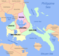
 Map of Laguna with Luisiana highlighted | |
OpenStreetMap  | |
 Luisiana Location within the Philippines | |
| Coordinates: 14°11′06″N 121°30′39″E / 14.185°N 121.5109°ECoordinates: 14°11′06″N 121°30′39″E / 14.185°N 121.5109°E | |
| Country | Philippines |
| Region | Calabarzon |
| Province | Laguna |
| District | 4th district |
| Founded | April 3, 1854 |
| Chartered | November 12, 1907 |
| Barangays | 23 (see Barangays) |
| Government | |
| • Type | Sangguniang Bayan |
| • Mayor | Nestor A. Rondilla |
| • Vice Mayor | Armando S. Taguilaso |
| • Representative | Benjamin C. Agarao Jr. |
| • Municipal Council | Members |
| • Electorate | 14,689 voters (2019) |
| Area | |
| • Total | 73.31 km2 (28.31 sq mi) |
| Highest elevation | 973 m (3,192 ft) |
| Lowest elevation | 10 m (30 ft) |
| Population (2020 census) [3] | |
| • Total | 20,859 |
| • Density | 280/km2 (740/sq mi) |
| • Households | 4,635 |
| Demonym(s) | Luisiense/Louisianian |
| Economy | |
| • Income class | 4th municipal income class |
| • Poverty incidence | 8.57% (2015)[4] |
| • Revenue | ₱101,672,885.24 (2020) |
| • Assets | ₱309,411,625.65 (2020) |
| • Expenditure | ₱98,442,573.68 (2020) |
| • Liabilities | ₱124,714,841.31 (2020) |
| Service provider | |
| • Electricity | Manila Electric Company (Meralco) |
| Time zone | UTC+8 (PST) |
| ZIP code | 4032 |
| PSGC | |
| IDD : area code | +63 (0)49 |
| Native languages | Tagalog |
Luisiana, officially the Municipality of Luisiana (Tagalog: Bayan ng Luisiana), is a 4th class municipality in the province of Laguna, Philippines. According to the 2020 census, it has a population of 20,859 people. [3]
Locals call the town Little Amigos Dísmo because of its high elevation and cool climate like the City of Baguio.[citation needed]
History[]
This section does not cite any sources. (January 2022) |
During the 17th century, there was an area of land in Laguna known as Terreno de Nasonog (Lupaín ng Nasonog in Tagalog). In 1678, Terreno de Nasúnog was divided into three parts: Nasúnog de Lucban, Nasonog de Cavinti, and Nasúnog de Majayjay.
Nasonog de Majayjay later became the town of Luisiana. It was only on April 3, 1854, that ecclesiastical independence was granted to Nasonog by the Governor-General (the Marqués de Novaliches) with the corresponding approval from the Archbishop of Manila, having Don Marcos Bartolomé as its first interim parish priest. Because of the role of Don Luis Bernárdo, which was then regarded as the Father of Luisiana, and his wife Doña Ana, the town was named 'Luis y Ana', later changed to 'Luisiana'.
In 1948, Visita de Luisiana gained civil independence from Majayjay.
In 1903, the towns of Cavinti and Luisiana were combined, Pedro Villanueva of Cavinti was elected mayor and it was during his term that the Aglipay Church was founded in April, 1904. The Romana family funded the construction of a couple of Protestant churches. However, on November 12, 1907, under the leadership of Don Blas Oración, through the Civil Commission, Cavinti and Luisiana became independent towns.
Geography[]
This section does not cite any sources. (January 2022) |
109 kilometres (68 mi) away from Manila and 22 kilometres (14 mi) away from the provincial capital, Santa Crúz, the town of Luisiana is bounded on the north by Pagsánjan and Cavinti, on the west by Magdalena and Majayjay, on the south by Lucban, Quezon, and Sampaloc in the east.
Luisiana occupies 8,096.33 hectares (20,006.5 acres) on a plateau 1,400 feet (430 m) atop the Sierra Madre mountains.
Barangays[]
This section does not cite any sources. (January 2022) |
Luisiana is politically subdivided into 23 barangays. [5]
- De La Paz
- Barangay Zone I (Poblacion)
- Barangay Zone II (Poblacion)
- Barangay Zone III (Poblacion)
- Barangay Zone IV (Poblacion)
- Barangay Zone V (Poblacion)
- Barangay Zone VI (Poblacion)
- Barangay Zone VII (Poblacion)
- Barangay Zone VIII (Poblacion)
- San Antonio
- San Buenaventura
- San Diego
- San Isidro
- San José
- San Juan
- San Luis
- San Pablo
- San Pedro
- San Rafaél
- San Roque
- San Salvador
- Santo Domingo
- Santo Tomás
Climate[]
The climate is cold, humid, and tropical. The average yearly temperature is around 26 °C (78.8 °F).
| Climate data for Luisiana, Laguna | |||||||||||||
|---|---|---|---|---|---|---|---|---|---|---|---|---|---|
| Month | Jan | Feb | Mar | Apr | May | Jun | Jul | Aug | Sep | Oct | Nov | Dec | Year |
| Average high °C (°F) | 24 (75) |
25 (77) |
26 (79) |
29 (84) |
29 (84) |
28 (82) |
27 (81) |
27 (81) |
27 (81) |
26 (79) |
25 (77) |
24 (75) |
26 (80) |
| Average low °C (°F) | 20 (68) |
20 (68) |
20 (68) |
21 (70) |
22 (72) |
22 (72) |
22 (72) |
22 (72) |
22 (72) |
21 (70) |
21 (70) |
20 (68) |
21 (70) |
| Average precipitation mm (inches) | 58 (2.3) |
41 (1.6) |
32 (1.3) |
29 (1.1) |
91 (3.6) |
143 (5.6) |
181 (7.1) |
162 (6.4) |
172 (6.8) |
164 (6.5) |
113 (4.4) |
121 (4.8) |
1,307 (51.5) |
| Average rainy days | 13.4 | 9.3 | 9.1 | 9.8 | 19.1 | 22.9 | 26.6 | 24.9 | 25.0 | 21.4 | 16.5 | 16.5 | 214.5 |
| Source: Meteoblue [6] | |||||||||||||
Demographics[]
| Year | Pop. | ±% p.a. |
|---|---|---|
| 1903 | 4,174 | — |
| 1918 | 5,224 | +1.51% |
| 1939 | 6,963 | +1.38% |
| 1948 | 6,883 | −0.13% |
| 1960 | 8,746 | +2.02% |
| 1970 | 11,494 | +2.77% |
| 1975 | 12,346 | +1.44% |
| 1980 | 12,199 | −0.24% |
| 1990 | 14,241 | +1.56% |
| 1995 | 16,269 | +2.53% |
| 2000 | 17,109 | +1.09% |
| 2007 | 19,255 | +1.64% |
| 2010 | 20,148 | +1.66% |
| 2015 | 19,720 | −0.41% |
| 2020 | 20,859 | +1.11% |
| Source: Philippine Statistics Authority [7] [8] [9][10] | ||
In the 2020 census, the population of Luisiana, Laguna, was 20,859 people, [3] with a density of 280 inhabitants per square kilometre or 730 inhabitants per square mile.
Economy[]
This section does not cite any sources. (January 2022) |
Luisiana is basically an agricultural town. At the población, there are only a few commercial establishments which cater to the basic services of the people. Most of them still go to Santa Crúz to do their shopping or marketing and to avail themselves of other services not available in their town.
Sources of income of the people of Luisiana are mainly focused on agriculture such as copra, pandan, palay, bamboo and bunliw, with light industry base and service-sector economy. Piggery and poultry farming are also an additional income.
Sister cities[]
Gallery[]

Plaza with Municipal Hall in background

Luisiana Roman Catholic Church

Liceo de Luisiana

Bonifacio Elementary School


References[]
- ^ Municipality of Luisiana | (DILG)
- ^ "2015 Census of Population, Report No. 3 – Population, Land Area, and Population Density" (PDF). Philippine Statistics Authority. Quezon City, Philippines. August 2016. ISSN 0117-1453. Archived (PDF) from the original on May 25, 2021. Retrieved July 16, 2021.
- ^ a b c Census of Population (2020). "Region IV-A (Calabarzon)". Total Population by Province, City, Municipality and Barangay. PSA. Retrieved 8 July 2021.
- ^ https://psa.gov.ph/sites/default/files/City%20and%20Municipal-level%20Small%20Area%20Poverty%20Estimates_%202009%2C%202012%20and%202015_0.xlsx; publication date: 10 July 2019; publisher: Philippine Statistics Authority.
- ^ "Province: Laguna". PSGC Interactive. Quezon City, Philippines: Philippine Statistics Authority. Retrieved 12 November 2016.
- ^ "Luisiana: Average Temperatures and Rainfall". Meteoblue. Retrieved 11 May 2020.
- ^ Census of Population (2015). "Region IV-A (Calabarzon)". Total Population by Province, City, Municipality and Barangay. PSA. Retrieved 20 June 2016.
- ^ Census of Population and Housing (2010). "Region IV-A (Calabarzon)". Total Population by Province, City, Municipality and Barangay. NSO. Retrieved 29 June 2016.
- ^ Censuses of Population (1903–2007). "Region IV-A (Calabarzon)". Table 1. Population Enumerated in Various Censuses by Province/Highly Urbanized City: 1903 to 2007. NSO.
- ^ "Province of Laguna". Municipality Population Data. Local Water Utilities Administration Research Division. Retrieved 17 December 2016.
- ^ "Poverty incidence (PI):". Philippine Statistics Authority. Retrieved 28 December 2020.
- ^ https://psa.gov.ph/sites/default/files/NSCB_LocalPovertyPhilippines_0.pdf; publication date: 29 November 2005; publisher: Philippine Statistics Authority.
- ^ https://psa.gov.ph/sites/default/files/2003%20SAE%20of%20poverty%20%28Full%20Report%29_1.pdf; publication date: 23 March 2009; publisher: Philippine Statistics Authority.
- ^ https://psa.gov.ph/sites/default/files/2006%20and%202009%20City%20and%20Municipal%20Level%20Poverty%20Estimates_0_1.pdf; publication date: 3 August 2012; publisher: Philippine Statistics Authority.
- ^ https://psa.gov.ph/sites/default/files/2012%20Municipal%20and%20City%20Level%20Poverty%20Estima7tes%20Publication%20%281%29.pdf; publication date: 31 May 2016; publisher: Philippine Statistics Authority.
- ^ https://psa.gov.ph/sites/default/files/City%20and%20Municipal-level%20Small%20Area%20Poverty%20Estimates_%202009%2C%202012%20and%202015_0.xlsx; publication date: 10 July 2019; publisher: Philippine Statistics Authority.
External links[]
| Wikimedia Commons has media related to Luisiana. |
- Luisiana Profile at PhilAtlas.com
- Philippine Standard Geographic Code
- Philippine Census Information
- Local Governance Performance Management System
Places adjacent to Luisiana | ||||||||||||||||
|---|---|---|---|---|---|---|---|---|---|---|---|---|---|---|---|---|
| ||||||||||||||||
Santa Cruz (capital) | ||
| Municipalities |  | |
| Component Cities | ||
| Barangays | ||
- Municipalities of Laguna (province)