Sarıkamış
Sarıkamış | |
|---|---|
 Sarıkamış | |
| Coordinates: 40°20′17″N 42°34′23″E / 40.33806°N 42.57306°ECoordinates: 40°20′17″N 42°34′23″E / 40.33806°N 42.57306°E | |
| Country | |
| Province | Kars |
| Government | |
| • Mayor | Göksal Toksoy (AKP) |
| • Kaymakam | Yusuf İzzet Karaman |
| Area | |
| • District | 1,971.01 km2 (761.01 sq mi) |
| Population (2012)[2] | |
| • Urban | 19,727 |
| • District | 50,308 |
| • District density | 26/km2 (66/sq mi) |
| Post code | 36500 |
| Website | www.sarikamis.bel.tr |

Sarıkamış (Kurdish: Zerqamîş,[3] Armenian: Եղէգնիկ, romanized: Eġēgnik[4]) is a town and a district of Kars Province in the Eastern Anatolia region of Turkey. Its population was 17,860 in 2010. The town sits in a valley and is surrounded by mountains, many of which are covered with pine forests. It has a subalpine climate, with average of 7–8 ft/2.1m-2.4m of snowfall; it has very long winters and short, dry summers. In recent years Sarıkamış has developed as a winter skiing resort, with one of the world's longest tracks.
The Sarıkamış district neighbours the districts of Selim and Kağızman to east, Şenkaya and Horasan to the west, Eleşkirt to the south, Selim and Şenkaya to the north and occupies an area of 1732 km2. Its average altitude is 1500–2000 m, and Aladag Mountain, at 3138 m, is within its borders. Other important mountains are Süphan, Balıklı (2835m), Kösedağı (2599m), Çıplakdağ (2634m) and Soğanlı (2849m). The Kars and Aras rivers flow through it.
Extensive barracks from the Russian period surround the town and are still in use by the Turkish army. Other historical buildings include the town's former Russian cathedral, known locally as Yanik Kilise, now used as a mosque after being used as a cinema for many years. A hunting lodge, built for a visit by Czar Nicolas, is located at the edge of the pine forests.

History[]
For most of the 19th century, Sarikamish was an insignificant settlement that was divided into two parts: upper Sarikamish and lower Sarikamish.
Nothing is known of its earlier history, but nearby archaeological sites date from Urartian times: there is a Urartian fortress on a hill beside upper Sarikamish, another, 12 km away, beside Chatak village, and a third, 15 km away, at a site known as Yedikilise.[5] To the east and south of the town, in the forests of Soğanlı, there were many medieval Armenian monasteries, but most were in ruins by 1878.[6]
Seljuk sultan Alp Arslan invaded the Sarikamish area including Allahüekber Dağları and Soğanlı mountains in 1064, only a few years prior to the battle of Manzikert between the armies of Alp Arslan and Byzantines[citation needed]. The area was then taken by Suleiman the Magnificent in 1534 and became a liva of Kars sancak of the Ottoman Empire.
In the 19th century the region around Sarikamish became a conflict zone between the Ottoman and Russian empires. Battles took place at nearby Zivin in 1829, 1855 and 1877.
After the Russo-Turkish War of 1877-78, Sarikamish became part of the Russian empire, incorporated within the militarily administered Kars Oblast, which was renowned for the extreme ethnic diversity of its population. Lower Sarikamish developed into a small, modern town. Being close to the Ottoman border, it was also a military station with barracks for two regiments. It had a railway station that was the railhead for the line running from Kars and Alexandropol.[7]

An important battle took place between the armies of the Ottoman and Russian empires in and around the city in late December 1914-January 1915 as part of the Caucasus Campaign of World War I.
Enver Pasha, the leader of the Ittihat ve Terakki party in Istanbul, personally led the army along with Hafiz Hakki Pasha, who was his brother in-law, to scale the Mount Allahu Ekber and afterwards attack the Russian army in Sarikamish. Enver Pasha intended to occupy the town in order to halt logistic support to the city of Kars, which the Turks lost to the Russians in 1878, and which he was planning to reoccupy.
In mid December, Enver Pasha entered the Caucasus region through Armenia. Enver ordered his forces to attack along many routes with the goal of arriving suddenly at Sarikamis at the same time. The chief German military advisor, Liman von Sanders strongly argued against this plan but was ignored. Governor General Vorontsov planned to withdraw his forces to the city of Kars. But General Yudenich, in charge of the defense of the area, ignored Vorontsov's wishes to withdraw and instead stayed to defend Sarikamis.[8]
Enver's forces lost touch with one another and arrived at Sarakamis at different times from December 29 through the 3rd of January. The first divisions to arrive briefly took control of the barracks in the western part of the city but were driven off. In the following days, as more Ottoman forces arrived at the battle, they attacked without coordination and the Russians under the skillful command of Yudenich fought off the attacks one by one. The battle finally ended on January 4 and the Ottoman army retreated in complete disorganization back through the mountains in the middle of winter.
The number of Turkish losses is estimated to be 60,000-80,000 dead out of an army of 90,000. It is very likely that the majority of Turkish soldiers died because of inadequate winter clothing and field shelters during the attack and retreat. In any event, this was an extraordinarily costly defeat for the Turks; in losses this was the worst single defeat they suffered in the entire war. Turkish soldiers reached their targets but they were too weak to win. The Russian casualties were estimated at 35,000.[9]
As one German officer attached to the army wrote later, the Ottoman 3rd army had "suffered a disaster which for rapidity and completeness is without parallel in military history."[10]
In 2005 the Turkish Army's , located here, was reduced to a brigade, still part of Third Army.
External links[]
| Wikimedia Commons has media related to Sarıkamış. |
See also[]
- Soğuksu Nature Park, a 2011-established nature park 3 km (1.9 mi) southeast of Sarıkamış.
Virtual Tour - Panoramic Photos[]
References[]
- ^ "Area of regions (including lakes), km²". Regional Statistics Database. Turkish Statistical Institute. 2002. Retrieved 2013-03-05.
- ^ "Population of province/district centers and towns/villages by districts - 2012". Address Based Population Registration System (ABPRS) Database. Turkish Statistical Institute. Retrieved 2013-02-27.
- ^ İbrahim Sediyani (2009). Adını arayan coğrafya. Özedönüş Yayınları. p. 310. ISBN 9786054296002.
- ^ Garegin Pasdermadjian, "Why Armenia Should be Free" p. 21.
- ^ Sinclair, Thomas Allen, "Eastern Turkey, an Architectural and Archeological Survey", volume one p417-418, London, 1987.
- ^ Parsegian, V. L. (project director), "Armenian Architecture: A Documented Photo-Archival Collection on Microfiche", volumes 1.
- ^ W.E.D. Allen & P. Muratoff, "Caucasian Battlefields", p263, Cambridge, 1953.
- ^ T.N. Dupuy's Encyclopedia of Military History (many editions)
- ^ Tucker, Spencer. The Great War: 1914-18 (1998)
- ^ , David Fromkin, 1989 page 121
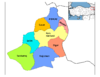
| show Sarıkamış in Kars Province of Turkey |
|---|
| show Authority control |
|---|
- Towns in Turkey
- Ski areas and resorts in Turkey
- Populated places in Kars Province
- Districts of Kars Province
- Kars Oblast
- Kurdish settlements in Turkey