Aiglepierre
Aiglepierre | |
|---|---|
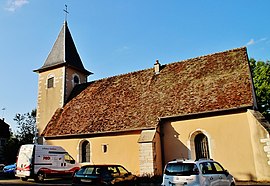 The church in Aiglepierre | |
show Location of Aiglepierre | |
 Aiglepierre | |
| Coordinates: 46°57′11″N 5°49′11″E / 46.9531°N 5.8197°ECoordinates: 46°57′11″N 5°49′11″E / 46.9531°N 5.8197°E | |
| Country | France |
| Region | Bourgogne-Franche-Comté |
| Department | Jura |
| Arrondissement | Dole |
| Canton | Arbois |
| Intercommunality | |
| Government | |
| • Mayor (2014-2020) | Guy David |
| Area 1 | 6.97 km2 (2.69 sq mi) |
| Population (Jan. 2018)[1] | 445 |
| • Density | 64/km2 (170/sq mi) |
| Time zone | UTC+01:00 (CET) |
| • Summer (DST) | UTC+02:00 (CEST) |
| INSEE/Postal code | 39006 /39110 |
| Elevation | 278–631 m (912–2,070 ft) |
| 1 French Land Register data, which excludes lakes, ponds, glaciers > 1 km2 (0.386 sq mi or 247 acres) and river estuaries. | |


Aiglepierre is a commune in the Jura department in the region of Bourgogne-Franche-Comté in eastern France.
Population[]
| Year | Pop. | ±% |
|---|---|---|
| 2006 | 397 | — |
| 2007 | 405 | +2.0% |
| 2008 | 413 | +2.0% |
| 2009 | 421 | +1.9% |
| 2010 | 428 | +1.7% |
| 2011 | 426 | −0.5% |
| 2012 | 424 | −0.5% |
| 2013 | 422 | −0.5% |
| 2014 | 413 | −2.1% |
| 2015 | 417 | +1.0% |
| 2016 | 426 | +2.2% |
See also[]
References[]
- ^ "Populations légales 2018". INSEE. 28 December 2020.
| Wikimedia Commons has media related to Aiglepierre. |
This Jura geographical article is a stub. You can help Wikipedia by . |
Categories:
- Communes of Jura (department)
- Jura (department) geography stubs