Charézier
Charézier | |
|---|---|
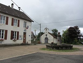 The town hall in Charézier | |
show Location of Charézier | |
 Charézier | |
| Coordinates: 46°36′41″N 5°43′41″E / 46.6114°N 5.7281°ECoordinates: 46°36′41″N 5°43′41″E / 46.6114°N 5.7281°E | |
| Country | France |
| Region | Bourgogne-Franche-Comté |
| Department | Jura |
| Arrondissement | Lons-le-Saunier |
| Canton | Saint-Laurent-en-Grandvaux |
| Government | |
| • Mayor (2020–2026) | Stéphane Bellat |
| Area 1 | 9.26 km2 (3.58 sq mi) |
| Population (Jan. 2018)[1] | 177 |
| • Density | 19/km2 (50/sq mi) |
| Time zone | UTC+01:00 (CET) |
| • Summer (DST) | UTC+02:00 (CEST) |
| INSEE/Postal code | 39109 /39130 |
| Elevation | 434–609 m (1,424–1,998 ft) |
| 1 French Land Register data, which excludes lakes, ponds, glaciers > 1 km2 (0.386 sq mi or 247 acres) and river estuaries. | |


Charézier (French pronunciation: [ʃaʁezje]) is a commune in the Jura department in Bourgogne-Franche-Comté in eastern France.
Population[]
|
|
See also[]
References[]
- ^ "Populations légales 2018". INSEE. 28 December 2020.
| Wikimedia Commons has media related to Charézier. |
| Authority control |
|
|---|
This Jura geographical article is a stub. You can help Wikipedia by . |
Categories:
- Communes of Jura (department)
- Jura (department) geography stubs