Pannessières
Pannessières | |
|---|---|
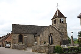 The church in Pannessières | |
show Location of Pannessières | |
 Pannessières | |
| Coordinates: 46°41′55″N 5°35′56″E / 46.6986°N 5.5989°ECoordinates: 46°41′55″N 5°35′56″E / 46.6986°N 5.5989°E | |
| Country | France |
| Region | Bourgogne-Franche-Comté |
| Department | Jura |
| Arrondissement | Lons-le-Saunier |
| Canton | Poligny |
| Government | |
| • Mayor (2020–2026) | Maurice Monnet |
| Area 1 | 5.35 km2 (2.07 sq mi) |
| Population (Jan. 2018)[1] | 486 |
| • Density | 91/km2 (240/sq mi) |
| Time zone | UTC+01:00 (CET) |
| • Summer (DST) | UTC+02:00 (CEST) |
| INSEE/Postal code | 39404 /39570 |
| Elevation | 280–527 m (919–1,729 ft) |
| 1 French Land Register data, which excludes lakes, ponds, glaciers > 1 km2 (0.386 sq mi or 247 acres) and river estuaries. | |


Pannessières (French pronunciation: [pansjɛʁ]) is a commune in the Jura department in Bourgogne-Franche-Comté in eastern France.
Population[]
|
|
See also[]
References[]
- ^ "Populations légales 2018". INSEE. 28 December 2020.
| Wikimedia Commons has media related to Pannessières. |
This Jura geographical article is a stub. You can help Wikipedia by . |
Categories:
- Communes of Jura (department)
- Jura (department) geography stubs