La Frasnée
La Frasnée | |
|---|---|
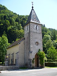 The church in La Frasnée | |
Location of La Frasnée  | |
 La Frasnée | |
| Coordinates: 46°33′27″N 5°48′41″E / 46.5575°N 5.8114°ECoordinates: 46°33′27″N 5°48′41″E / 46.5575°N 5.8114°E | |
| Country | France |
| Region | Bourgogne-Franche-Comté |
| Department | Jura |
| Arrondissement | Lons-le-Saunier |
| Canton | Saint-Laurent-en-Grandvaux |
| Government | |
| • Mayor (2020–2026) | Sylviane Perron |
| Area 1 | 3.19 km2 (1.23 sq mi) |
| Population (Jan. 2018)[1] | 39 |
| • Density | 12/km2 (32/sq mi) |
| Time zone | UTC+01:00 (CET) |
| • Summer (DST) | UTC+02:00 (CEST) |
| INSEE/Postal code | 39239 /39130 |
| Elevation | 538–775 m (1,765–2,543 ft) |
| 1 French Land Register data, which excludes lakes, ponds, glaciers > 1 km2 (0.386 sq mi or 247 acres) and river estuaries. | |


La Frasnée (French pronunciation: [la fʁane]) is a commune in the Jura department in Bourgogne-Franche-Comté in eastern France.
Population[]
|
|
See also[]
References[]
- ^ "Populations légales 2018". The National Institute of Statistics and Economic Studies. 28 December 2020.
| Wikimedia Commons has media related to La Frasnée. |
| Prefecture |
|
|---|---|
| Subprefectures |
|
| Other |
|
This Jura geographical article is a stub. You can help Wikipedia by . |
Categories:
- Communes of Jura (department)
- Jura (department) geography stubs