Toulouse-le-Château
Toulouse-le-Château | |
|---|---|
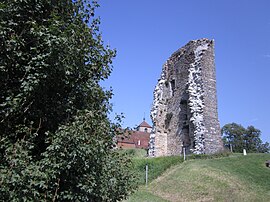 Ruins of the chateau | |
show Location of Toulouse-le-Château | |
 Toulouse-le-Château | |
| Coordinates: 46°49′26″N 5°35′16″E / 46.8239°N 5.5878°ECoordinates: 46°49′26″N 5°35′16″E / 46.8239°N 5.5878°E | |
| Country | France |
| Region | Bourgogne-Franche-Comté |
| Department | Jura |
| Arrondissement | Lons-le-Saunier |
| Canton | Bletterans |
| Government | |
| • Mayor (2020–2026) | Jean-Christian Kryzek |
| Area 1 | 4.16 km2 (1.61 sq mi) |
| Population (Jan. 2018)[1] | 219 |
| • Density | 53/km2 (140/sq mi) |
| Time zone | UTC+01:00 (CET) |
| • Summer (DST) | UTC+02:00 (CEST) |
| INSEE/Postal code | 39533 /39230 |
| Elevation | 223–352 m (732–1,155 ft) |
| 1 French Land Register data, which excludes lakes, ponds, glaciers > 1 km2 (0.386 sq mi or 247 acres) and river estuaries. | |


Toulouse-le-Château (French pronunciation: [tuluz lə ʃɑto]; literally 'Toulouse the Château') is a commune in the Jura department in the Bourgogne-Franche-Comté region in eastern France.
Population[]
|
|
See also[]
References[]
- ^ "Populations légales 2018". INSEE. 28 December 2020.
| Wikimedia Commons has media related to Toulouse-le-Château. |
| show Authority control |
|---|
This Jura geographical article is a stub. You can help Wikipedia by . |
Categories:
- Communes of Jura (department)
- Jura (department) geography stubs