Saint-Thiébaud
Saint-Thiébaud | |
|---|---|
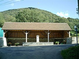 The wash house in Saint-Thiébaud | |
 Coat of arms | |
show Location of Saint-Thiébaud | |
 Saint-Thiébaud | |
| Coordinates: 46°58′22″N 5°51′57″E / 46.9728°N 5.8658°ECoordinates: 46°58′22″N 5°51′57″E / 46.9728°N 5.8658°E | |
| Country | France |
| Region | Bourgogne-Franche-Comté |
| Department | Jura |
| Arrondissement | Dole |
| Canton | Arbois |
| Government | |
| • Mayor (2020–2026) | Patrick Montevecchio |
| Area 1 | 7.94 km2 (3.07 sq mi) |
| Population (Jan. 2018)[1] | 62 |
| • Density | 7.8/km2 (20/sq mi) |
| Time zone | UTC+01:00 (CET) |
| • Summer (DST) | UTC+02:00 (CEST) |
| INSEE/Postal code | 39495 /39110 |
| Elevation | 380–850 m (1,250–2,790 ft) |
| 1 French Land Register data, which excludes lakes, ponds, glaciers > 1 km2 (0.386 sq mi or 247 acres) and river estuaries. | |


Saint-Thiébaud is a commune in the Jura department in the Bourgogne-Franche-Comté region in eastern France.
Population[]
| Year | Pop. | ±% |
|---|---|---|
| 1793 | 199 | — |
| 1806 | 240 | +20.6% |
| 1821 | 179 | −25.4% |
| 1831 | 161 | −10.1% |
| 1841 | 150 | −6.8% |
| 1851 | 156 | +4.0% |
| 1861 | 180 | +15.4% |
| 1872 | 147 | −18.3% |
| 1881 | 127 | −13.6% |
| 1891 | 130 | +2.4% |
| 1901 | 130 | +0.0% |
| 1911 | 135 | +3.8% |
| 1921 | 118 | −12.6% |
| 1931 | 105 | −11.0% |
| 1946 | 77 | −26.7% |
| 1954 | 79 | +2.6% |
| 1962 | 90 | +13.9% |
| 1968 | 61 | −32.2% |
| 1975 | 58 | −4.9% |
| 1982 | 67 | +15.5% |
| 1990 | 70 | +4.5% |
| 1999 | 60 | −14.3% |
| 2008 | 65 | +8.3% |
| 2013 | 69 | +6.2% |
See also[]
References[]
- ^ "Populations légales 2018". INSEE. 28 December 2020.
| Wikimedia Commons has media related to Saint-Thiébaud. |
This Jura geographical article is a stub. You can help Wikipedia by . |
Categories:
- Communes of Jura (department)
- Jura (department) geography stubs