Montmirey-le-Château
Montmirey-le-Château | |
|---|---|
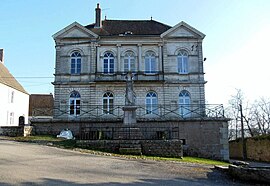 Town hall | |
show Location of Montmirey-le-Château | |
 Montmirey-le-Château | |
| Coordinates: 47°13′28″N 5°32′07″E / 47.2244°N 5.5353°ECoordinates: 47°13′28″N 5°32′07″E / 47.2244°N 5.5353°E | |
| Country | France |
| Region | Bourgogne-Franche-Comté |
| Department | Jura |
| Arrondissement | Dole |
| Canton | Authume |
| Government | |
| • Mayor (2020–2026) | Martin Daune |
| Area 1 | 8.02 km2 (3.10 sq mi) |
| Population (Jan. 2018)[1] | 196 |
| • Density | 24/km2 (63/sq mi) |
| Time zone | UTC+01:00 (CET) |
| • Summer (DST) | UTC+02:00 (CEST) |
| INSEE/Postal code | 39361 /39290 |
| Elevation | 204–293 m (669–961 ft) |
| 1 French Land Register data, which excludes lakes, ponds, glaciers > 1 km2 (0.386 sq mi or 247 acres) and river estuaries. | |


Montmirey-le-Château (French pronunciation: [mɔ̃miʁɛ l(ə) ʃɑto]) is a commune in the Jura department in Bourgogne-Franche-Comté in eastern France.
Population[]
|
|
See also[]
References[]
- ^ "Populations légales 2018". INSEE. 28 December 2020.
| Wikimedia Commons has media related to Montmirey-le-Château. |
This Jura geographical article is a stub. You can help Wikipedia by . |
Categories:
- Communes of Jura (department)
- Jura (department) geography stubs